Indonesia 印度尼西亚 => A Country of Beautiful Wood

Indonesia 印度尼西亚 => A Country of Beautiful Wood
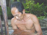

The Artisans

Indonesian Furniture Selection

The Objects

History of Indonesian Furniture

Indonesia 印度尼西亚 => A Country of Beautiful Wood

Updated 2023-11-09 09:24:11

Indonesia is a country on the continent Asia, her capital is Jakarta. Here is the hierarchy of the Indonesia administrative divisions: Indonesia is subdivided into provinces, that are at their turn subdivided into regencies (kabupaten), cities (kota), that are at their turn subdivided into districts, that are at their turn subdivided into towns and villages.

The names of countries/territories of the world are taught in English and Chinese. This collection of precious dry lands that shares the whole mankind includes not only the world's independent countries, but also specific areas that are not a UNUnited Nations: We the peoples...A stronger UN for a better world. member. Please visit the table of male and female genders of country names in French.

Countries/locations    Close
Indonesia | Countries/Territories | Regions of China | Provinces of China | Regions in France | French Departments | States/Provinces | Cities/Towns | Locations | World Continents | French AOP Wines

11

id
Country
Country
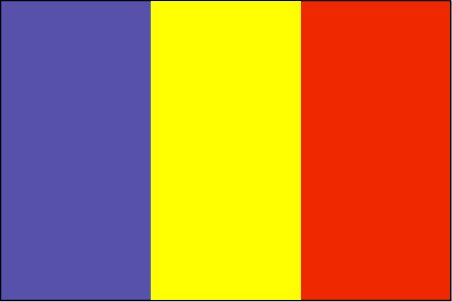
Chad
Country in French
Tchad
countryucasefr
TCHAD
Country in Chinese
Country in Spanish
Sábalo
Country in Italian
Il Ritaglio
Country in Portuguese
República do Tchad
Country in Germain
Tschad
countrypy
zha4 de2
countrylocal
Tchad
countryfull
Chad
countrynm
Chad
ISO2
TD
ISO3
TCD
countrycodeisono
148
countrycodevehicle
TCH
countrycodeolympic
CHA
countrycodeirs
CD
countrycodeirsfr
CD
countrycodeirsmixt
CD
♂Male
15
4
57
languagesfr
Arabe, Français
119
currency
franc
currencyfr
franc C.F.A.
currencyisocode
XAF
currencyisocodefull
XAF 950
currencypxcode
XAF
currencysymbol
CFAF
currencysubdivision
100 centimes
currencyregime
Euro (655.957)
currencyvalue
0.00186
nationalityfr
Chadienne
Capital
N'Djamena
capitalfr
N'Djamena
Phone Prefix
235
Area km2
1 284 000
arealand
1 259 200
areawater
24 800
landarablerate
0.0278
landforestrate
0.101
summit
Emi Koussi 3 415 m.
boundarycountries
Niger, Libye, Soudan, Centrafrique, Cameroun, Nigeria.
timezonedeltabegin
1
flaglink
maplink
tdcolor.gif
outlinemaplink
tdout.gif
visapassenger
-1
maincities
Sarh, Moundou, Abéché, Bongor, Doba, Lai, Koumra, Kélo.
largestcity
Ndjamena
largestcitypopulation
826 000
rankpopulation
83
Population
8 582 000
rankgdp
139
gdp
2608000000
rankgdpppp
123
gdpppp
10386000000
rankgni
151
gni
2073000000
rankincomeorigin
192
rankincome
206
income
240
rankincomeppp
185
incomeppp
1080
lifeexpectation
48.24
alphabetizationrate
0.46
natalityrate
0.0465
mortalityrate
0.01638
mortalityrateinfantile
0.09478
hdi
0.376
urbanization
0.241
nationalevent
Independence Day
nationaleventfr
Jour de l'Indépendance
nationalholiday
11 August (1960)
Birthday yyyy-mm-dd
1960-08-11 00:00:00
7
1
location
Central Africa, south of Libya
terrain
broad, arid plains in center, desert in north, mountains in northwest, lowlands in south
naturalresources
petroleum (unexploited but exploration under way),
9
Web
rgbback
16777215
todate
1

12

id
Country
Country
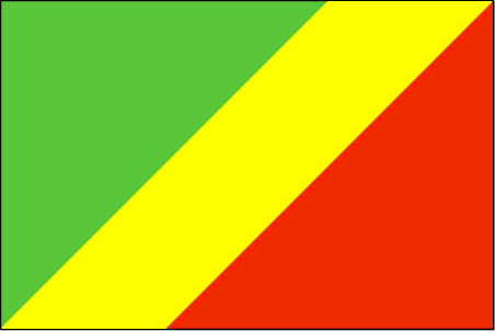
Congo
Country in French
Congo
countryucasefr
CONGO
Country in Chinese
Country in Spanish
Congo
Country in Italian
Il Congo
Country in Portuguese
Congo
Country in Germain
Der Kongo
countrypy
gang1 guo3 gong4 he2 guo2
countrylocal
République du Congo
countryfull
Congo, Republic of the
countrynm
Congo, Republic of the
ISO2
CG
ISO3
COG
countrycodeisono
178
countrycodevehicle
RCB
countrycodeolympic
CGO
countrycodeirs
CF
countrycodeirsfr
CF
countrycodeirsmixt
CF
♂Male
15
57
languagesfr
Français
119
currency
franc
currencyfr
franc C.F.A.
currencyisocode
XAF
currencyisocodefull
XAF 950
currencypxcode
XAF
currencysymbol
CFAF
currencysubdivision
100 centimes [*]
currencyregime
Euro (655.957)
currencyvalue
0.00186
nationalityfr
Congolaise
Capital
Brazzaville
capitalfr
Brazzaville
Phone Prefix
242
Area km2
342 000
arealand
341 500
areawater
500
landarablerate
0.005
coastline
169
summit
Monts de la Lékéti 1 040 m.
boundarycountries
Gabon, Cameroun, Centrafrique, Congo démocratique, Angola.
timezonedeltabegin
1
flaglink
maplink
cgcolor.gif
outlinemaplink
cgout.gif
visapassenger
-1
maincities
Pointe Noire, N'Kayi, Loubomo, Ngamaba-Mfilou, Loandjili, Massendjo.
largestcity
Brazzaville
rankpopulation
126
Population
3 757 000
rankgdp
130
gdp
3564000000
rankgdpppp
148
gdpppp
3625000000
rankgni
147
gni
2443000000
rankincomeorigin
153
rankincome
167
income
650
rankincomeppp
200
incomeppp
730
lifeexpectation
50.02
alphabetizationrate
0.566
natalityrate
0.02946
mortalityrate
0.0142
mortalityrateinfantile
0.09534
nationalevent
Independence Day
nationaleventfr
Jour de l'Indépendance
nationalholiday
15 August (1960)
Birthday yyyy-mm-dd
1960-08-15 00:00:00
7
1
location
Western Africa, bordering the South Atlantic Ocean, between Angola and Gabon
terrain
coastal plain, southern basin, central plateau, northern basin
naturalresources
petroleum, timber, potash, lead, zinc, uranium, co
9
Web
rgbback
16777215
todate
1

13

id
Country
Country
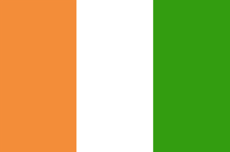
Cote d'Ivory
Country in French
Côte d'Ivoire
countryucasefr
COTE D'IVOIRE
Country in Chinese
Country in Spanish
Cote D'Ivoire (Costa de Marfil)
Country in Italian
Cote D'Ivoire (Costa D'avorio)
Country in Portuguese
Cote D'Ivoire (Costa De Marfim)
Country in Germain
Cote D'Ivoire (Die Elfenbeinküste)
countrypy
ke1 te4 di2 wa3
countrylocal
Cote d'Ivoire
countryfull
Cote d'Ivoire
countrynm
Cote d'Ivoire
ISO2
CI
ISO3
CIV
countrycodeisono
384
countrycodevehicle
CI
countrycodeolympic
CIV
countrycodeirs
IV
countrycodeirsfr
IV
countrycodeirsmixt
IV
countrycode
225
♀Female
15
4
57
languagesfr
Français
119
currency
franc
currencyfr
franc C.F.A.
currencyisocode
XOF
currencyisocodefull
XOF 952
currencypxcode
XOF
currencysymbol
CFAF
currencysubdivision
100 centimes
currencyregime
Euro (655.957)
currencyvalue
0.00186
nationality
Côte d'Ivoire
nationalityfr
Ivoirienne
Capital
Yamoussoukro
capitalfr
Yamoussoukro
Phone Prefix
225
Area km2
322 462
arealand
318 000
areawater
4 460
landarablerate
0.0928
landforestrate
0.224
coastline
515
summit
Mont Nimba 1 752 m.
boundarycountries
Burkina Faso, Liberia, Guinée, Mali, Ghana.
flaglink
maplink
cicolor.gif
outlinemaplink
ciout.gif
visapassenger
-1
maincities
Abidjan, Bouaké, Daloa, Man, Danané, Korhogo, Gagnoa.
largestcity
Yamoussoukro
largestcitypopulation
2 793 000
rankpopulation
55
Population
16 835 000
rankgdp
83
gdp
13734000000
rankgdpppp
91
gdpppp
24857000000
rankgni
86
gni
11124000000
rankincomeorigin
152
rankincome
166
income
660
rankincomeppp
180
incomeppp
1400
lifeexpectation
44.72
alphabetizationrate
0.538
natalityrate
0.03999
mortalityrate
0.01674
mortalityrateinfantile
0.09223
nationalevent
Independence Day
nationaleventfr
Jour de l'Indépendance
nationalholiday
7 August (1960)
Birthday yyyy-mm-dd
1960-08-07 00:00:00
7
1
location
Western Africa, bordering the North Atlantic Ocean, between Ghana and Liberia
terrain
mostly flat to undulating plains; mountains in northwest
naturalresources
petroleum, natural gas, diamonds, manganese, iron
cooking
Fruits Tropicaux.
9
Web
rgbback
16777215
todate
1
Notes
Fruits Tropicaux. Capital noted is official, Abidjan (de facto)

14

id
Country
Country
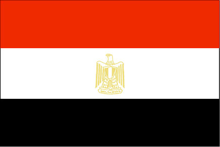
Egypt
Country in French
Egypte
countryucasefr
EGYPTE
Country in Chinese
Country in Spanish
Egipto
Country in Italian
L'Egitto
Country in Portuguese
Egipto
Country in Germain
Ägypten
countrypy
ai1 ji2
countrylocal
Misr
countryfull
Egypt
countrynm
Egypt
ISO2
EG
ISO3
EGY
countrycodeisono
818
countrycodevehicle
ET
countrycodeolympic
EGY
countrycodeirs
EG
countrycodeirsfr
EG
countrycodeirsmixt
EG
countrycode
20
♀Female
15
4
3
languagesfr
Arabe
36
currency
pound
currencyfr
livre égyptienne
currencyisocode
EGP
currencyisocodefull
EGP 818
currencypxcode
EGP
currencysymbol
£E
currencysubdivision
100 piasters or 1,000 milliemes
currencyregime
m.float
currencyvalue
0.173
nationalityfr
Egyptienne
Capital
Cairo
capitalfr
Le Caire
Phone Prefix
20
Area km2
1 001 449
arealand
995 450
areawater
6 000
landarablerate
0.0285
landforestrate
0.001
coastline
2450
summit
Jabal Katrînah 2 642 m
boundarycountries
Libye, Israël, Palestine, Soudan.
timezonedeltabegin
2
flaglink
maplink
egcolor.gif
outlinemaplink
egout.gif
visapassenger
-1
maincities
Alexandrie, Ismaïlia, Gîza, Port Saïd, Assiout, Helwân, Tanta, El Mahlla el Kubra, Zagazig, El Mansoura, Suez, Assouan.
largestcity
Cairo
largestcitypopulation
9 690 000
rankpopulation
17
Population
67 559 000
rankgdp
42
gdp
82427000000
rankgdpppp
29
gdpppp
266853000000
rankgni
38
gni
93850000000
rankincomeorigin
126
rankincome
138
income
1390
rankincomeppp
132
incomeppp
3940
lifeexpectation
70.41
alphabetizationrate
0.484
natalityrate
0.02436
mortalityrate
0.00535
mortalityrateinfantile
0.03526
nationalevent
Revolution Day
nationaleventfr
Jour de le Révolution
nationalholiday
23 July (1952)
Birthday yyyy-mm-dd
1952-07-23 00:00:00
9
5
location
Northern Africa, bordering the Mediterranean Sea, between Libya and the Gaza Strip, and the Red Sea north of Sudan, and includes the Asian Sinai Peninsula
terrain
vast desert plateau interrupted by Nile valley and delta
naturalresources
petroleum, natural gas, iron ore, phosphates, mang
9
Web
rgbback
16777215
todate
1

15

id
Country
Country
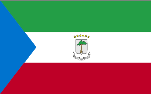
Equatorial Guinea
Country in French
Guinée équatoriale
countryucasefr
GUINEE EQUATORIALE
Country in Chinese
Country in Spanish
Guinea Ecuatorial
Country in Italian
Guinea Equatoriale
Country in Portuguese
Guinea Equatorial
Country in Germain
Äquatoriale Guine
countrypy
chi4 dao4 ji3 nei4 ya4
countrylocal
Guinea Ecuatorial
countryfull
Equatorial Guinea
countrynm
Equatorial Guinea
ISO2
GQ
ISO3
GNQ
countrycodeisono
226
countrycodeolympic
GEQ
countrycodeirs
EK
countrycodeirsfr
EK
countrycodeirsmixt
EK
♀Female
15
4
131
languagesfr
Espagnol
119
currency
franc
currencyfr
franc C.F.A.
currencyisocode
GQE
currencyisocodefull
GQE 226
currencypxcode
GQE
currencysymbol
CFAF
currencysubdivision
100 centimos
currencyregime
Euro (655.957)
nationalityfr
Guinéenne
Capital
Malabo
capitalfr
Malabo
Phone Prefix
240
Area km2
28 051
arealand
28 051
landarablerate
0.0463
landforestrate
0.625
coastline
296
summit
Pico de Santa Isabel 3 008 m.
boundarycountries
Cameroun, Gabon.
timezonedeltabegin
1
flaglink
maplink
gqcolor.gif
outlinemaplink
gqout.gif
visapassenger
-1
maincities
Bata, Luba, Mbini, Evinayong, Ebebiyin, Mongono.
largestcity
Malabo
largestcitypopulation
30 000
rankpopulation
161
Population
494 000
rankgdp
135
gdp
2915000000
rankgdpppp
128
gdpppp
8988000000
rankgni
195
gni
327000000
rankincomeorigin
150
rankincome
165
income
700
rankincomeppp
116
incomeppp
5100
lifeexpectation
55.15
alphabetizationrate
0.85
natalityrate
0.03656
mortalityrate
0.01227
mortalityrateinfantile
0.08708
hdi
0.664
urbanization
0.493
nationalevent
Independence Day
nationaleventfr
Jour de l'Indépendance
nationalholiday
12 October (1968)
Birthday yyyy-mm-dd
1968-10-12 00:00:00
5
9
location
Western Africa, bordering the Bight of Biafra, between Cameroon and Gabon
terrain
coastal plains rise to interior hills; islands are volcanic
naturalresources
oil, petroleum, timber, small unexploited deposits
9
Web
rgbback
16777215
todate
1

More+
A | B | C | D | E | F | G | H | I | J | K | L | M | N | O | P | Q | R | S | T | U | V | W | X | Y | Z
 

Give us feedback (37)

37. Visitor *.*.164.* - 2022-03-16 17:43:29
Buenas recomendaciones y todo lo que lleva el contenido de la web es increíble!
36. Visitor *.*.222.* - 2022-02-09 12:45:33
Los materiales que se utilizan para realizar este tipo de prácticas están todos hechos de madera!
35. Visitor *.*.225.* - 2022-01-24 16:55:06
Buenas ideas sabemos como podemos inspirarnos gracias a links así!
34. Visitor *.*.32.* - 2022-01-19 19:32:41
Los sitios web de esta manera me inspiran a seguir trabajando duro!
33. Visitor *.*.146.* - 2021-11-26 15:19:37
Excellent information on your content, thank you for taking the time to share with us.
Email Web

Please copy the string:
String to copy.

Chinese Shoes > Chad 乍得 => Indonesia 印度尼西亚 => A Country of Beautiful Wood
  

Want to come? | Call us 7/700 33 467 790 487 (Phone)

Popup Window    Close
Patience please...