Pays/Territoires
Mise à jour 2021-01-12 18:58:56
Les noms des pays/territoires du monde sont donnés en Français et Chinois. Cette collection des précieuses terres fermes du monde que toute l'humanité partage inclut non seulement les pays indépendants, mais aussi des régions spécifiques qui ne sont pas membre de l'ONUOrganisation des Nations Unies: Nous, peuples des Nations Unies ... Une ONU plus forte pour un monde meilleur. Veuillez aussi consulter les noms des pays en masculin et féminin en Français.
GéoPays Fermer
11
id
Pays
Pays en Anglais
Dominica
Pays
Dominique
countryucasefr
DOMINIQUE
Pays en Chinois
Pays en Espagnol
Dominica
Pays en Italien
Dominica
Pays en Portugais
Dominica
Pays en Allemand
Dominica
countrypy
duo1 ming2 ni2 jia1
countrylocal
Dominica
countryfull
Dominica
countrynm
Dominica
ISO2
DM
ISO3
DMA
countrycodeisono
212
countrycodevehicle
WD
countrycodeolympic
DMA
countrycodeirs
DO
countrycodeirsfr
DO
countrycodeirsmixt
DO
♀Féminin
18
6
51
languagesfr
Anglais, Français.
35
currency
dollar
currencyfr
dollar des Caraïbes orientales
currencyisocode
XCD
currencyisocodefull
XCD 951
currencypxcode
XCD
currencysymbol
EC$
currencysubdivision
100 cents
currencyregime
US-$ (2.7)
currencyvalue
0.3745
nationalityfr
Dominicaine
Capitale
Roseau
capitalfr
Roseau
Préfixe Tél.
1-767
Superficie km2
753
arealand
754
landarablerate
0.04
landforestrate
0.613
coastline
148
summit
Morne Diablotin 1 447 m.
timezonedeltabegin
-4
flaglink
maplink
dmcolor.gif
outlinemaplink
dm.gif
visapassenger
-1
maincities
Portsmouth, Marigot, Berekua, Saint Joseph.
largestcity
Roseau
largestcitypopulation
21 000
rankpopulation
195
Population
71 000
rankgdp
177
gdp
259000000
rankgdpppp
166
gdpppp
388000000
rankgni
202
gni
237000000
rankincomeorigin
90
rankincome
100
income
3330
rankincomeppp
118
incomeppp
5020
lifeexpectation
74.38
alphabetizationrate
0.94
natalityrate
0.01625
fecondity
2.01
mortalityrate
0.0069
mortalityrateinfantile
0.01475
growthrate
-0.00452
hdi
0.776
urbanization
0.7169
precipitation
654
nationalevent
Independence Day
nationaleventfr
Jour de l'Indépendance
nationalholiday
3 November (1978)
Date de naissance aaaa-mm-jj
1978-11-03 00:00:00
5
7
location
Caribbean, island between the Caribbean Sea and the North Atlantic Ocean, about one-half of the way from Puerto Rico to Trinidad and Tobago
terrain
rugged mountains of volcanic origin
naturalresources
timber, hydropower, arable land
9
Web
rgbback
16777215
todate
1
12
id
Pays
Pays en Anglais
Dominican Republic
Pays
République Dominicaine
countryucasefr
DOMINICAINE (REPUBLIQUE)
Pays en Chinois
Pays en Espagnol
República Dominicana
Pays en Italien
Repubblica Domenicana
Pays en Portugais
República Dominican
Pays en Allemand
Dominikanische Republik
countrypy
duo1 mi3 ni2 jia1 gong4 he2 guo2
countrylocal
Dominicana, Republica
countryfull
Dominican Republic
countrynm
Dominican Republic
ISO2
DO
ISO3
DOM
countrycodeisono
214
countrycodevehicle
DOM
countrycodeolympic
DOM
countrycodeirs
DR
countrycodeirsfr
DR
countrycodeirsmixt
DR
countrycode
1809
♀Féminin
18
6
131
languagesfr
Espagnol
34
currency
peso
currencyfr
peso dominicain
currencyisocode
DOP
currencyisocodefull
DOP 214
currencypxcode
DOP
currencysymbol
RD$
currencysubdivision
100 centavos
currencyregime
m.float
currencyvalue
0.03472
nationalityfr
Dominicaine
Capitale
Santo Domingo
capitalfr
Saint-Domingue
Préfixe Tél.
1-809
Superficie km2
48 734
arealand
48 380
areawater
350
landarablerate
0.2108
landforestrate
0.284
coastline
1288
summit
Pico Duarte 3 175 m.
boundarycountries
Haïti.
timezonedeltabegin
-4
flaglink
maplink
docolor.gif
outlinemaplink
do.gif
visapassenger
-1
maincities
Santiago, La Vega, Puerto Plata, Barahona, La Romana, San Pedro de Macoris, San Francisco de Macoris, San Juan.
largestcity
Santo Domingo
largestcitypopulation
3 166 000
rankpopulation
82
Population
8 739 000
rankgdp
80
gdp
16541000000
rankgdpppp
65
gdpppp
59622000000
rankgni
72
gni
18601000000
rankincomeorigin
107
rankincome
117
income
2130
rankincomeppp
99
incomeppp
6310
lifeexpectation
67.63
alphabetizationrate
0.8435
natalityrate
0.0236
mortalityrate
0.0071
mortalityrateinfantile
0.03328
hdi
0.737
urbanization
0.66
precipitation
1448
nationalevent
Independence Day
nationaleventfr
Jour de l'Indépendance
nationalholiday
27 February (1844)
Date de naissance aaaa-mm-jj
1844-02-27 00:00:00
1
5
location
Caribbean, eastern two-thirds of the island of Hispaniola, between the Caribbean Sea and the North Atlantic Ocean, east of Haiti
terrain
rugged highlands and mountains with fertile valleys interspersed
naturalresources
nickel, bauxite, gold, silver
cooking
Fruits de Mer
9
Web
rgbback
16777215
todate
1
Notes
Fruits de Mer
13
id
Pays
Pays en Anglais
Ecuador
Pays
Equateur
countryucasefr
EQUATEUR
Pays en Chinois
Pays en Espagnol
Ecuador
Pays en Italien
L'Ecuador
Pays en Portugais
Equador
Pays en Allemand
Ecuador
countrypy
e4 gua1 duo1 er3
countrylocal
Ecuador
countryfull
Ecuador
countrynm
Ecuador
ISO2
EC
ISO3
ECU
countrycodeisono
218
countrycodevehicle
EC
countrycodeolympic
ECU
countrycodeirs
EC
countrycodeirsfr
EC
countrycodeirsmixt
EC
countrycode
593
♂Masulin
15
6
131
languagesfr
Espagnol
6
currency
dollar
currencyfr
dollar
currencyisocode
USD
currencyisocodefull
USD 840
currencypxcode
USD
currencysymbol
$
currencysubdivision
100 cents
currencyregime
float
currencyvalue
1
nationalityfr
Equatorienne
Capitale
Quito
capitalfr
Quito
Préfixe Tél.
593
Superficie km2
283 561
arealand
276 840
areawater
6 720
landarablerate
0.0569
landforestrate
0.381
coastline
2237
summit
Chimborazo 6 267 m.
boundarycountries
Colombie, Pérou.
timezonedeltabegin
-5
flaglink
maplink
eccolor.gif
outlinemaplink
ec.gif
visapassenger
-1
maincities
Guayaquil, Cuenca, Machala, Portoviejo, Riobamba, Ambato, Manta, Esmeraldas.
largestcity
Guayaquil
largestcitypopulation
1 831 000
rankpopulation
63
Population
13 008 000
rankgdp
63
gdp
27201000000
rankgdpppp
69
gdpppp
47362000000
rankgni
66
gni
23772000000
rankincomeorigin
117
rankincome
128
income
1830
rankincomeppp
137
incomeppp
3440
lifeexpectation
71.89
alphabetizationrate
0.8975
natalityrate
0.02494
mortalityrate
0.00529
mortalityrateinfantile
0.03197
hdi
0.732
precipitation
1026
nationalevent
Independence Day (independence of Quito)
nationaleventfr
Jour de l'Indépendance (indépendance de Quito)
nationalholiday
10 August (1809)
Date de naissance aaaa-mm-jj
1809-08-10 00:00:00
6
6
location
Western South America, bordering the Pacific Ocean at the Equator, between Colombia and Peru
terrain
coastal plain (costa), inter-Andean central highlands (sierra), and flat to rolling eastern jungle (oriente)
naturalresources
petroleum, fish, timber, hydropower
cooking
Fruits de Mer
9
Web
rgbback
16777215
todate
1
Notes
Fruits de Mer
14
id
Pays
Pays en Anglais
El Salvador
Pays
El Salvador
countryucasefr
EL SALVADOR
Pays en Chinois
Pays en Espagnol
Salvador De EL
Pays en Italien
Salvador Di EL
Pays en Portugais
Salvador De EL
Pays en Allemand
EL-Salvador
countrypy
sa4 er3 wa3 duo1
countrylocal
El Salvador
countryfull
El Salvador
countrynm
El Salvador
ISO2
SV
ISO3
SLV
countrycodeisono
222
countrycodevehicle
ES
countrycodeolympic
ESA
countrycodeirs
EL
countrycodeirsfr
EL
countrycodeirsmixt
EL
countrycode
503
♂Masulin
15
6
131
languagesfr
Espagnol
37
currency
colon
currencyfr
colon
currencyisocode
SVC
currencyisocodefull
SVC 222
currencypxcode
SVC
currencysymbol
¢
currencysubdivision
100 centavos
currencyregime
float
currencyvalue
0.1143
nationalityfr
Salvadorienne
Capitale
San Salvador
capitalfr
San Salvador
Préfixe Tél.
503
Superficie km2
21 041
arealand
20 720
areawater
320
landarablerate
0.2727
landforestrate
0.058
coastline
307
summit
Cerro El Pital 2 730 m.
boundarycountries
Guatémala, Honduras.
timezonedeltabegin
-6
flaglink
maplink
svcolor.gif
outlinemaplink
svoutl.gif
visapassenger
-1
maincities
Santa Ana, San Miguel, Nueva San Salvador, Sonsonate, Cojutepeque.
largestcity
San Salvador
largestcitypopulation
1 214 000
rankpopulation
97
Population
6 533 000
rankgdp
81
gdp
14879000000
rankgdpppp
83
gdpppp
31237000000
rankgni
82
gni
15282000000
rankincomeorigin
100
rankincome
110
income
2340
rankincomeppp
122
incomeppp
4910
lifeexpectation
70.92
alphabetizationrate
0.798
natalityrate
0.02748
mortalityrate
0.00593
mortalityrateinfantile
0.02593
hdi
0.729
urbanization
0.615
nationalevent
Independence Day
nationaleventfr
Jour de l'Indépendance
nationalholiday
15 September (1821)
Date de naissance aaaa-mm-jj
1821-09-15 00:00:00
8
6
location
Middle America, bordering the North Pacific Ocean, between Guatemala and Honduras
terrain
mostly mountains with narrow coastal belt and central plateau
naturalresources
hydropower, geothermal power, petroleum, arable la
9
Web
rgbback
16777215
todate
1
15
id
Pays
Pays en Anglais
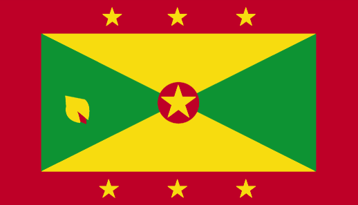
Grenada
Pays
Grenade
countryucasefr
GRENADE
Pays en Chinois
Pays en Espagnol
Grenada
Pays en Italien
La Granada
Pays en Portugais
Grenada
Pays en Allemand
Grenada
countryfull
Grenada
countrynm
Grenada
ISO2
GD
ISO3
GRD
countrycodeisono
308
countrycodevehicle
WG
countrycodeolympic
GRN
countrycodeirs
GJ
countrycodeirsfr
GJ
countrycodeirsmixt
GJ
12
6
51
languagesfr
Anglais
35
currency
dollar
currencyfr
dollar des Caraïbes orientales
currencyisocode
XCD
currencyisocodefull
XCD 951
currencypxcode
XCD
currencysymbol
EC$
currencysubdivision
100 cents
currencyregime
US-$ (2.7)
currencyvalue
0.3745
Capitale
Saint George's
capitalfr
Saint-George's
Préfixe Tél.
1-473
Superficie km2
344
arealand
344
landarablerate
0.0588
landforestrate
0.147
coastline
121
summit
Mount Saint Catherine 840 m.
timezonedeltabegin
-4
flaglink
maplink
gdcolor.gif
outlinemaplink
gd.gif
visapassenger
-1
maincities
Gouyave, Hillsborough, Grenville, Sauteurs, Grand Roy.
largestcity
St George
largestcitypopulation
33 000
rankpopulation
187
Population
105 000
rankgdp
169
gdp
439000000
rankgdpppp
159
gdpppp
833000000
rankgni
190
gni
388000000
rankincomeorigin
85
rankincome
94
income
3710
rankincomeppp
89
incomeppp
7030
lifeexpectation
64.52
alphabetizationrate
0.98
natalityrate
0.02261
fecondity
2.5
mortalityrate
0.00731
mortalityrateinfantile
0.01462
hdi
0.738
nationalevent
Independence Day
nationaleventfr
Jour de l'Indépendance
nationalholiday
7 February (1974)
Date de naissance aaaa-mm-jj
1974-02-07 00:00:00
1
3
location
Caribbean, island between the Caribbean Sea and Atlantic Ocean, north of Trinidad and Tobago
terrain
volcanic in origin with central mountains
naturalresources
timber, tropical fruit, deepwater harbors
9
Web
rgbback
16777215
todate
1
16
id
Pays
Pays en Anglais
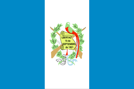
Guatemala
Pays
Guatemala
countryucasefr
GUATEMALA
Pays en Chinois
Pays en Espagnol
Guatemala
Pays en Italien
Il Guatemala
Pays en Portugais
Guatemala
Pays en Allemand
Guatemala
countrypy
gua1 di4 ma3 la1
countrylocal
Guatemala
countryfull
Guatemala
countrynm
Guatemala
ISO2
GT
ISO3
GTM
countrycodeisono
320
countrycodevehicle
GCA
countrycodeolympic
GUA
countrycodeirs
GT
countrycodeirsfr
GT
countrycodeirsmixt
GT
countrycode
502
♂Masulin
19
6
131
languagesfr
Espagnol
43
currency
quetzal
currencyfr
quetzal
currencyisocode
GTQ
currencyisocodefull
GTQ 320
currencypxcode
GTQ
currencysymbol
Q
currencysubdivision
100 centavos
currencyregime
float
currencyvalue
0.1317
Capitale
Guatemala City
capitalfr
Guatemala
Préfixe Tél.
502
Superficie km2
108 890
arealand
108 430
areawater
460
landarablerate
0.1254
landforestrate
0.263
coastline
400
summit
Volcán Tajumulco 4 220 m
boundarycountries
Mexique, Bélize, El Salvador, Honduras.
timezonedeltabegin
-6
flaglink
maplink
gtcolor.gif
outlinemaplink
gtoutl.gif
visapassenger
-1
maincities
Escuintla, Quezaltenango, Puerto Barrios, Retlahuleu, Cobán, Chiquimula, Mazatenangoy
largestcity
Guatemala City
largestcitypopulation
2 205 000
rankpopulation
64
Population
12 307 000
rankgdp
66
gdp
24730000000
rankgdpppp
66
gdpppp
51056000000
rankgni
67
gni
23486000000
rankincomeorigin
114
rankincome
124
income
1910
rankincomeppp
130
incomeppp
4090
lifeexpectation
65.26
alphabetizationrate
0.551
natalityrate
0.03551
mortalityrate
0.00677
mortalityrateinfantile
0.03896
nationalevent
Independence Day
nationaleventfr
Jour de l'Indépendance
nationalholiday
15 September (1821)
Date de naissance aaaa-mm-jj
1821-09-15 00:00:00
8
6
location
Middle America, bordering the North Pacific Ocean, between El Salvador and Mexico, and bordering the Gulf of Honduras (Caribbean Sea) between Honduras and Belize
terrain
mostly mountains with narrow coastal plains and rolling limestone plateau (Peten)
naturalresources
petroleum, nickel, rare woods, fish, chicle, hydro
9
Web
rgbback
16777215
todate
1
17
id
Pays
Pays en Anglais
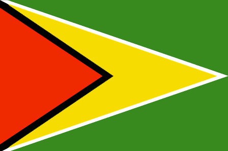
Guyana
Pays
Guyana
countryucasefr
GUYANA
Pays en Chinois
Pays en Espagnol
Guyana
Pays en Italien
La Guyana
Pays en Portugais
Guyana
Pays en Allemand
Guyana
countrypy
gui1 ya4 na4
countrylocal
Guyana
countryfull
Guyana
countrynm
Guyana
ISO2
GY
ISO3
GUY
countrycodeisono
328
countrycodevehicle
GUY
countrycodeolympic
GUY
countrycodeirs
GY
countrycodeirsfr
GY
countrycodeirsmixt
GY
♂Masulin
15
6
51
languagesfr
Anglais
45
currency
dollar
currencyfr
dollar de Guyana
currencyisocode
GYD
currencyisocodefull
GYD 328
currencypxcode
GYD
currencysymbol
G$
currencysubdivision
100 cents
currencyregime
float
currencyvalue
0.0056
nationalityfr
Guyanaise
Capitale
Georgetown
capitalfr
Georgetown
Préfixe Tél.
592
Superficie km2
214 970
arealand
196 850
areawater
18 120
landarablerate
0.0244
landforestrate
0.785
coastline
459
summit
Mount Roraima 2 772 m.
boundarycountries
Vénézuéla, Surinam, Brésil .
timezonedeltabegin
-3
flaglink
maplink
gycolor.gif
outlinemaplink
gy.gif
visapassenger
-1
maincities
Linden, New Amsterdam, Corriverton, Mahaicony.
largestcity
Georgetown
largestcitypopulation
254 000
rankpopulation
156
Population
769 000
rankgdp
161
gdp
742000000
rankgdpppp
149
gdpppp
3253000000
rankgni
182
gni
689000000
rankincomeorigin
142
rankincome
155
income
900
rankincomeppp
131
incomeppp
3980
lifeexpectation
62.43
alphabetizationrate
0.9865
natalityrate
0.01785
mortalityrate
0.00971
mortalityrateinfantile
0.03722
hdi
0.74
urbanization
0.00467
precipitation
2262
nationalevent
Republic Day
nationaleventfr
Jour de la République
nationalholiday
23 February (1970)
Date de naissance aaaa-mm-jj
1970-02-23 00:00:00
7
11
location
Northern South America, bordering the North Atlantic Ocean, between Suriname and Venezuela
terrain
mostly rolling highlands; low coastal plain; savanna in south
naturalresources
bauxite, gold, diamonds, hardwood timber, shrimp,
cooking
Sucre.
9
rgbback
16777215
todate
1
Notes
Sucre.
18
id
Pays
Pays en Anglais
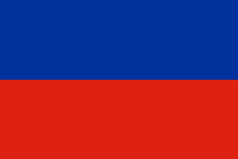
Haiti
Pays
Haïti
countryucasefr
HAITI
Pays en Chinois
Pays en Espagnol
Haití
Pays en Italien
L'Haiti
Pays en Portugais
Haiti
Pays en Allemand
Haiti
countrypy
hai3 di4
countrylocal
Haiti
countryfull
Haiti
countrynm
Haiti
ISO2
HT
ISO3
HTI
countrycodeisono
332
countrycodevehicle
RH
countrycodeolympic
HAI
countrycodeirs
HA
countrycodeirsfr
HA
countrycodeirsmixt
HA
8
57
languagesfr
Français, créole.
140
currency
gourde
currencyfr
gourde
currencyisocode
HTG
currencyisocodefull
HTG 332
currencypxcode
HTG
currencysymbol
G
currencysubdivision
100 centimes
currencyregime
float
currencyvalue
0.0274
nationalityfr
Haïtienne
Capitale
Port-au-Prince
capitalfr
Port-au-Prince
Préfixe Tél.
509
Superficie km2
247,50
arealand
27 560
areawater
190
landarablerate
0.2032
landforestrate
0.032
coastline
1771
summit
Pic La Selle 2 674 m.
boundarycountries
République Dominicaine.
timezonedeltabegin
-5
flaglink
maplink
htcolor.gif
outlinemaplink
ht.gif
visapassenger
-1
maincities
Cap Haïtien, Pétionville, Gonaives, Les Cayes, Port-de-Paix.
largestcity
Port-au-Prince
largestcitypopulation
1 461 000
rankpopulation
84
Population
8 440 000
rankgdp
134
gdp
2921000000
rankgdpppp
107
gdpppp
14703000000
rankgni
139
gni
3342000000
rankincomeorigin
173
rankincome
187
income
400
rankincomeppp
170
incomeppp
1730
lifeexpectation
51.78
alphabetizationrate
0.5195
natalityrate
0.03376
mortalityrate
0.01321
mortalityrateinfantile
0.07438
hdi
0.467
urbanization
0.363
nationalevent
Independence Day
nationaleventfr
Jour de l'Indépendance
nationalholiday
1 January (1804)
Date de naissance aaaa-mm-jj
1804-01-01 00:00:00
10
12
location
Caribbean, western one-third of the island of Hispaniola, between the Caribbean Sea and the North Atlantic Ocean, west of the Dominican Republic
terrain
mostly rough and mountainous
naturalresources
bauxite, copper, calcium carbonate, gold, marble,
9
Web
rgbback
16777215
todate
1
19
id
Pays
Pays en Anglais
Honduras
Pays
Honduras
countryucasefr
HONDURAS
Pays en Chinois
Pays en Espagnol
Honduras
Pays en Italien
L'Honduras
Pays en Portugais
Honduras
Pays en Allemand
Honduras
countrypy
hong2 du1 la1 si1
countrylocal
Honduras
countryfull
Honduras
countrynm
Honduras
ISO2
HN
ISO3
HND
countrycodeisono
340
countrycodeolympic
HON
countrycodeirs
HO
countrycodeirsfr
HO
countrycodeirsmixt
HO
countrycode
504
♂Masulin
19
6
131
languagesfr
Espagnol
46
currency
lempira
currencyfr
lempira
currencyisocode
HNL
currencyisocodefull
HNL 340
currencypxcode
HNL
currencysymbol
L
currencysubdivision
100 centavos
currencyregime
m.float
currencyvalue
0.05549
Capitale
Tegucigalpa
capitalfr
Tegucigalpa
Préfixe Tél.
504
Superficie km2
112 088
arealand
111 890
areawater
200
landarablerate
0.1515
landforestrate
0.481
coastline
820
summit
Cerro Las Minas 2 865
boundarycountries
Guatémala, El Salvador, Nicaragua.
timezonedeltabegin
-6
flaglink
maplink
hncolor.gif
outlinemaplink
hnoutl.gif
visapassenger
-1
maincities
San Pedro Sula, La Ceiba, Choluteca, El Progeso, Puerto Cortés, Comayagua, Tela, Siguatepeque.
largestcity
Tegucigalpa
largestcitypopulation
995 000
rankpopulation
93
Population
6 969 000
rankgdp
103
gdp
6978000000
rankgdpppp
100
gdpppp
18572000000
rankgni
103
gni
6760000000
rankincomeorigin
137
rankincome
148
income
970
rankincomeppp
149
incomeppp
2590
lifeexpectation
66.15
alphabetizationrate
0.7565
natalityrate
0.03104
mortalityrate
0.00664
mortalityrateinfantile
0.02964
hdi
0.667
urbanization
0.537
precipitation
873
nationalevent
Independence Day
nationaleventfr
Jour de l'Indépendance
nationalholiday
15 September (1821)
Date de naissance aaaa-mm-jj
1821-09-15 00:00:00
8
6
location
Middle America, bordering the Caribbean Sea, between Guatemala and Nicaragua and bordering the Gulf of Fonseca (North Pacific Ocean), between El Salvador and Nicaragua
terrain
mostly mountains in interior, narrow coastal plains
naturalresources
timber, gold, silver, copper, lead, zinc, iron ore
cooking
Fruits de Mer
9
Web
rgbback
16777215
todate
1
Notes
Fruits de Mer
20
id
Pays
Pays en Anglais
Jamaica
Pays
Jamaïque
countryucasefr
JAMAIQUE
Pays en Chinois
Pays en Espagnol
Jamaica
Pays en Italien
La Giamaica
Pays en Portugais
Jamaica
Pays en Allemand
Jamaika
countrypy
ya2 mai3 jia1
countrylocal
Jamaica
countryfull
Jamaica
countrynm
Jamaica
ISO2
JM
ISO3
JAM
countrycodeisono
388
countrycodevehicle
JA
countrycodeolympic
JAM
countrycodeirs
JM
countrycodeirsfr
JM
countrycodeirsmixt
JM
♀Féminin
20
6
51
languagesfr
Anglais
55
currency
dollar
currencyfr
dollar de la Jamaïque
currencyisocode
JMD
currencyisocodefull
JMD 388
currencypxcode
JMD
currencysymbol
J$
currencysubdivision
100 cents
currencyregime
float
currencyvalue
0.02
nationalityfr
Jamaïcaine
Capitale
Kingston
capitalfr
Kingston
Préfixe Tél.
1-876
Superficie km2
10 991
arealand
10 831
areawater
160
landarablerate
0.1607
landforestrate
0.3
coastline
1022
summit
Blue Mountain Peak 2 256 m.
timezonedeltabegin
-5
flaglink

maplink
jmcolor.gif
outlinemaplink
jm.gif
visapassenger
-1
maincities
Spanish Town, Montego Bay, May Pen, Mandeville, Savanna la Mar
largestcity
Kingston
largestcitypopulation
621 000
rankpopulation
135
Population
2 643 000
rankgdp
97
gdp
8147000000
rankgdpppp
121
gdpppp
10846000000
rankgni
100
gni
7882000000
rankincomeorigin
92
rankincome
102
income
2980
rankincomeppp
134
incomeppp
3790
lifeexpectation
76.07
alphabetizationrate
0.875
natalityrate
0.01694
mortalityrate
0.0054
mortalityrateinfantile
0.01281
hdi
0.757
urbanization
0.566
nationalevent
Independence Day
nationaleventfr
Jour de l'Indépendance
nationalholiday
First Monday in August (1962)
Date de naissance aaaa-mm-jj
1962-08-01 00:00:00
9
3
location
Caribbean, island in the Caribbean Sea, south of Cuba
terrain
mostly mountains, with narrow, discontinuous coastal plain
naturalresources
bauxite, gypsum, limestone
9
Web
rgbback
16777215
todate
1
| Pays/Territoires | Régions en Chine | Provinces de Chine | Régions en France | Départements de France | Provinces du Monde | Villes/Villages | Localités | Continents du Monde | Vins AOP
