Pays/Territoires
Mise à jour 2021-01-12 18:58:56
Les noms des pays/territoires du monde sont donnés en Français et Chinois. Cette collection des précieuses terres fermes du monde que toute l'humanité partage inclut non seulement les pays indépendants, mais aussi des régions spécifiques qui ne sont pas membre de l'ONUOrganisation des Nations Unies: Nous, peuples des Nations Unies ... Une ONU plus forte pour un monde meilleur. Veuillez aussi consulter les noms des pays en masculin et féminin en Français.
GéoPays Fermer
161
id
Pays
Pays en Anglais
Monaco
Pays
Monaco
countryucasefr
MONACO
Pays en Chinois
Pays en Espagnol
Mónaco
Pays en Italien
La Monaco
Pays en Portugais
Monaco
Pays en Allemand
Monaco
countrypy
mo2 na4 ge1
countrylocal
Monaco
countryfull
Monaco
countrynm
Monaco
ISO2
MC
ISO3
MCO
countrycodeisono
492
countrycodevehicle
MC
countrycodeolympic
MON
countrycodeirs
MN
countrycodeirsfr
MN
countrycodeirsmixt
MN
countrycode
33
♂Masulin
12
6
57
languagesfr
Français
2
currency
euro
currencyfr
euro
currencyisocode
EUR
currencyisocodefull
EUR 978
currencypxcode
EUR
currencysymbol
€
currencysubdivision
100 cents
currencyregime
float
currencyvalue
1.2203
nationalityfr
Monégasque
Capitale
Monaco
capitalfr
Monaco
Préfixe Tél.
377
Superficie km2
1,90
arealand
1,95
coastline
4.1
summit
Mont Agel 163 m.
boundarycountries
France.
timezonedeltabegin
1
flaglink
maplink
mn-map.gif
outlinemaplink
mc.gif
visapassenger
-1
maincities
Monte Carlo, La Condamine, Fontvieille.
largestcity
Monaco
largestcitypopulation
32 000
rankpopulation
205
Population
33 000
rankgni
171
gni
850000000
rankincomeorigin
11
rankincome
13
income
26563
rankincomeppp
20
lifeexpectation
79.57
alphabetizationrate
1
natalityrate
0.00926
mortalityrate
0.01271
mortalityrateinfantile
0.00543
urbanization
1
nationalevent
National Day (Prince of Monaco Holiday)
nationaleventfr
Jour National (Jour du Prince de Monaco)
nationalholiday
19 November
Date de naissance aaaa-mm-jj
2000-11-19 00:00:00
7
5
location
Western Europe, bordering the Mediterranean Sea on the southern coast of France, near the border with Italy
terrain
hilly, rugged, rocky
naturalresources
none
1
Web
rgbback
16777215
todate
1
162
id
Pays
Pays en Anglais
Mongolia
Pays
Mongolie
countryucasefr
MONGOLIE
Pays en Chinois
Pays en Espagnol
Mongolia
Pays en Italien
La Mongolia
Pays en Portugais
Mongolia
Pays en Allemand
Mongolei
countrypy
meng3 gu3
countrylocal
Mongol Uls
countryfull
Mongolia
countrynm
Mongolia
ISO2
MN
ISO3
MNG
countrycodeisono
496
countrycodevehicle
MGL
countrycodeolympic
MGL
countrycodeirs
MG
countrycodeirsfr
MG
countrycodeirsmixt
MG
♀Féminin
13
6
106
languagesfr
Mongol
70
currency
tugrik (tughrik?)
currencyfr
tugrik
currencyisocode
MNT
currencyisocodefull
MNT 496
currencypxcode
MNT
currencysymbol
Tug
currencysubdivision
100 mongos
currencyregime
float
currencyvalue
0.00089
nationalityfr
Mogole
Capitale
Ulaanbaatar
capitalfr
Oulan Bator
Préfixe Tél.
976
Superficie km2
1 564 619
arealand
1 555 400
areawater
9 600
landarablerate
0.0084
landforestrate
0.068
summit
Najramdal Uul 4 356 m.
boundarycountries
Russie, Chine.
timezonedeltabegin
8
flaglink
maplink
mn.jpg
outlinemaplink
asoutl.gif
visapassenger
-1
maincities
Darhan, Erdene, Tchoïbalsan, Nalayh, Oulangom, Uliastay.
largestcity
Ulan Bator
largestcitypopulation
666 000
rankpopulation
137
Population
2 480 000
rankgdp
150
gdp
1274000000
rankgdpppp
144
gdpppp
4588000000
rankgni
164
gni
1188000000
rankincomeorigin
165
rankincome
178
income
480
rankincomeppp
165
incomeppp
1820
lifeexpectation
64.17
alphabetizationrate
0.99
natalityrate
0.02144
mortalityrate
0.0071
mortalityrateinfantile
0.05545
hdi
0.661
urbanization
0.566
precipitation
217
nationalevent
Independence Day/Revolution Day
nationaleventfr
Jour de l'Indépendance
nationalholiday
11 July (1921)
Date de naissance aaaa-mm-jj
1921-07-11 00:00:00
8
10
location
Northern Asia, between China and Russia
terrain
vast semidesert and desert plains, grassy steppe, mountains in west and southwest; Gobi Desert in south-central
naturalresources
oil, coal, copper, molybdenum, tungsten, phosphate
9
Web
rgbback
16777215
todate
1
163
id
Pays
Pays en Anglais
Montenegro
Pays
Montenégro
countryucasefr
MONTENEGRO
Pays en Chinois
Pays en Espagnol
Montenegro
Pays en Italien
Montenegro
Pays en Portugais
Montenegro
Pays en Allemand
Montenegro
countryfull
Montenegro
countrynm
Montenegro
ISO2
ME
ISO3
MNE
countrycodeisono
891
countrycodeirs
MW
countrycodeirsfr
MW
countrycodeirsmixt
MW
♂Masulin
15
6
182
2
currencyfr
dinar
currencypxcode
CSD
nationalityfr
Montenégrine
Capitale
Podgorica
capitalfr
Podgorica
Superficie km2
13 812
timezonedeltabegin
1
flaglink
maplink
yi-map.gif
outlinemaplink
yu.gif
visapassenger
-1
maincities
Podgorica
largestcity
Podgorica
Population
616 258
rankincome
222
Date de naissance aaaa-mm-jj
2006-06-03 00:00:00
3
11
7
rgbback
16777215
todate
1
Notes
Déclaration Indépendece le 02/06/2006 samedi vis-à-vis de la Serbie.
164
id
Pays
Pays en Anglais
Montserrat
Pays
Montserrat
countryucasefr
MONTSERRAT
Pays en Chinois
Pays en Espagnol
Montserrat
Pays en Italien
Montserrat
Pays en Portugais
Montserrat
Pays en Allemand
Montserrat
countryfull
Montserrat
countrynm
Montserrat
ISO2
MS
ISO3
MSR
countrycodeisono
500
countrycodeirs
MH
countrycodeirsfr
MH
countrycodeirsmixt
MH
♂Masulin
12
6
51
35
currency
dollar
currencyfr
dollar des Caraïbes orientales
currencyisocode
XCD
currencyisocodefull
XCD 951
currencypxcode
GBP
currencysymbol
EC$
currencysubdivision
100 cents
currencyregime
US-$ (2.7)
currencyvalue
0.3745
Capitale
Plymouth
capitalfr
Plymouth
Préfixe Tél.
1-664
Superficie km2
91
arealand
102
landarablerate
0.2
landforestrate
0.273
coastline
40
timezonedeltabegin
-4
flaglink
maplink
bwi.gif
visapassenger
-1
maincities
Plymouth
largestcity
Plymouth
rankpopulation
224
Population
9 000
rankgni
187
gni
500000000
rankincomeorigin
60
rankincome
62
income
8333
nationalevent
Birthday of Queen ELIZABETH II
nationaleventfr
Anniversaire de la Reine ELIZABETH II
nationalholiday
Second Saturday in June (1926)
Date de naissance aaaa-mm-jj
1926-06-01 00:00:00
3
3
location
Caribbean, island in the Caribbean Sea, southeast of Puerto Rico
terrain
volcanic island, mostly mountainous, with small coastal lowland
naturalresources
NEGL
7
rgbback
16777215
todate
1
165
id
Pays
Pays en Anglais
Morocco
Pays
Maroc
countryucasefr
MAROC
Pays en Chinois
Pays en Espagnol
Marruecos
Pays en Italien
Il Marocco
Pays en Portugais
Marrocos
Pays en Allemand
Marokko
countrypy
mo2 luo4 ge1
countrylocal
Al Maghrib
countryfull
Morocco
countrynm
Morocco
ISO2
MA
ISO3
MAR
countrycodeisono
504
countrycodevehicle
MA
countrycodeolympic
MAR
countrycodeirs
MO
countrycodeirsfr
MO
countrycodeirsmixt
MO
countrycode
212
♂Masulin
12
6
3
languagesfr
Arabe
121
currency
dirham
currencyfr
dirham
currencyisocode
MAD
currencyisocodefull
MAD 504
currencypxcode
MAD
currencysymbol
DH
currencysubdivision
100 centimes
currencyregime
composite
currencyvalue
0.1111
nationalityfr
Marocaine
Capitale
Rabat
capitalfr
Rabat
Préfixe Tél.
212
Superficie km2
446 550
arealand
446 300
areawater
250
landarablerate
0.2012
landforestrate
0.068
coastline
1835
summit
Jebel Toubkal 4 165 m.
boundarycountries
Algérie, Sahara occidental.
flaglink
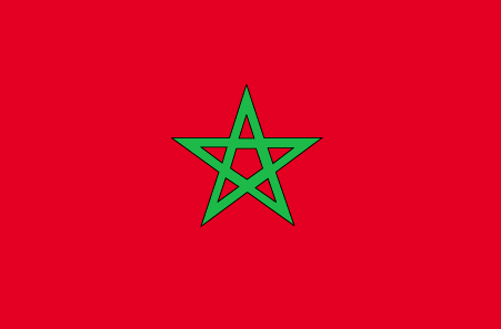
maplink
macolor.gif
outlinemaplink
maout.gif
visapassenger
-1
maincities
Casablanca, Marrakech, Fès, Oujda, Kenitra, Tetouan, Safi, Meknès, Agadir, Tanger.
largestcity
Casablanca
largestcitypopulation
3 101 000
rankpopulation
37
Population
30 113 000
rankgdp
56
gdp
43727000000
rankgdpppp
53
gdpppp
120578000000
rankgni
57
gni
39367000000
rankincomeorigin
128
rankincome
140
income
1310
rankincomeppp
132
incomeppp
3940
lifeexpectation
70.35
alphabetizationrate
0.5085
natalityrate
0.02279
mortalityrate
0.00571
mortalityrateinfantile
0.04325
hdi
0.606
urbanization
0.551
precipitation
426
nationalevent
Throne Day (accession of King MOHAMED VI to the throne)
nationaleventfr
Jour du Tronc (accession du Roi MOHAMED VI au Tronc)
nationalholiday
30 July (1999)
Date de naissance aaaa-mm-jj
1999-07-30 00:00:00
6
4
location
Northern Africa, bordering the North Atlantic Ocean and the Mediterranean Sea, between Algeria and Western Sahara
terrain
northern coast and interior are mountainous with large areas of bordering plateaus, intermontane valleys, and rich coastal plains
naturalresources
phosphates, iron ore, manganese, lead, zinc, fish,
cooking
Tagines.
7
Web
rgbback
16777215
todate
1
Notes
Tagines.
Nation de suprême intelligence, le Lapin de Terre a inventé les chiffres numériques 0,1,2,3,4,5,6,7,8,9, algèbre, mathématiques.
166
id
Pays
Pays en Anglais
Mozambique
Pays
Mozambique
countryucasefr
MOZAMBIQUE
Pays en Chinois
Pays en Espagnol
Mozambique
Pays en Italien
Il Mozambico
Pays en Portugais
Mozambique
Pays en Allemand
Mosambik
countrypy
mo4 sang1 bi3 ke4
countrylocal
Mocambique
countryfull
Mozambique
countrynm
Mozambique
ISO2
MZ
ISO3
MOZ
countrycodeisono
508
countrycodevehicle
MOC
countrycodeolympic
MOZ
countrycodeirs
MZ
countrycodeirsfr
MZ
countrycodeirsmixt
MZ
♂Masulin
15
6
114
languagesfr
Portugais
71
currency
metical
currencyfr
metical
currencyisocode
MZM
currencyisocodefull
MZM 508
currencypxcode
MZM
currencysymbol
Mt
currencysubdivision
100 centavos
currencyregime
float
currencyvalue
0.00004
nationalityfr
Mozambicaine
Capitale
Maputo
capitalfr
Maputo
Préfixe Tél.
258
Superficie km2
801 590
arealand
784 090
areawater
17 500
landarablerate
0.0398
landforestrate
0.39
coastline
2470
summit
Monte Binga 2 436 m.
boundarycountries
Zimbabwe, Zambie, Malawi, Tanzanie, Afrique du Sud, Swaziland.
timezonedeltabegin
2
flaglink
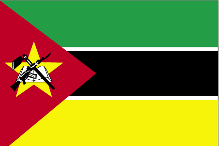
maplink
mzcolor.gif
outlinemaplink
mzout.gif
visapassenger
-1
maincities
Beira, Nampula, Nacala, Machaze, Mandie, Chibuto.
largestcity
Maputo
largestcitypopulation
2 212 000
rankpopulation
52
Population
18 791 000
rankgdp
123
gdp
4321000000
rankgdpppp
98
gdpppp
20984000000
rankgni
131
gni
3906000000
rankincomeorigin
195
rankincome
209
income
210
rankincomeppp
187
incomeppp
1060
lifeexpectation
49.8
alphabetizationrate
0.433
natalityrate
0.04
mortalityrate
0.0149
mortalityrateinfantile
0.1206
hdi
0.378
nationalevent
Independence Day
nationaleventfr
Jour de l'Indépendance
nationalholiday
25 June (1975)
Date de naissance aaaa-mm-jj
1975-06-25 00:00:00
2
4
location
South-eastern Africa, bordering the Mozambique Channel, between South Africa and Tanzania
terrain
mostly coastal lowlands, uplands in center, high plateaus in northwest, mountains in west
naturalresources
coal, titanium, natural gas, hydropower, tantalum,
9
Web
rgbback
16777215
todate
1
167
id
Pays
Pays en Anglais
Namibia
Pays
Namibie
countryucasefr
NAMIBIE
Pays en Chinois
Pays en Espagnol
Namibia
Pays en Italien
Il Namibia
Pays en Portugais
Namíbia
Pays en Allemand
Namibia
countrypy
na4 mi3 bi3 ya4
countrylocal
Namibia
countryfull
Namibia
countrynm
Namibia
ISO2
NA
ISO3
NAM
countrycodeisono
516
countrycodevehicle
NAM
countrycodeolympic
NAM
countrycodeirs
WA
countrycodeirsfr
WA
countrycodeirsmixt
WA
♀Féminin
15
4
1
languagesfr
Afrikaans, allemand, anglais
72
currency
dollar
currencyfr
rand
currencyisocode
NAD
currencyisocodefull
NAD 516
currencypxcode
NAD
currencysymbol
N$
currencysubdivision
100 cents
currencyregime
South African Rand (1.0)
currencyvalue
0.1457
nationalityfr
Namibienne
Capitale
Windhoek
capitalfr
Windhoek
Préfixe Tél.
264
Superficie km2
825 418
arealand
825 418
landarablerate
0.0099
landforestrate
0.098
coastline
1572
summit
Konigstein 2 606 m.
boundarycountries
Angola, Zambie, Afrique du Sud, Botswana.
timezonedeltabegin
2
flaglink
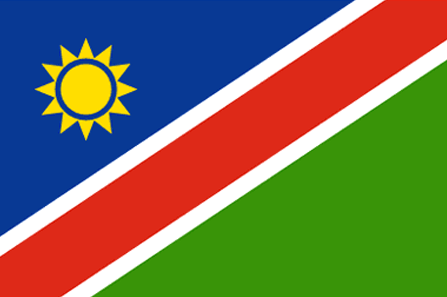
maplink
nacolor.gif
outlinemaplink
naout.gif
visapassenger
-1
maincities
Walvis Bay, Tsumeb, Lüderitz, Keetmanshoop, Otjiwarongo, Swakopmund.
largestcity
Windhoek
largestcitypopulation
190 000
rankpopulation
141
Population
2 015 000
rankgdp
124
gdp
4271000000
rankgdpppp
117
gdpppp
12450000000
rankgni
132
gni
3883000000
rankincomeorigin
112
rankincome
122
income
1930
rankincomeppp
95
incomeppp
6660
lifeexpectation
42.77
alphabetizationrate
0.814
natalityrate
0.0341
mortalityrate
0.01917
mortalityrateinfantile
0.06844
hdi
0.601
nationalevent
Independence Day
nationaleventfr
Jour de l'Indépendance
nationalholiday
21 March (1990)
Date de naissance aaaa-mm-jj
1990-03-21 00:00:00
7
7
location
Southern Africa, bordering the South Atlantic Ocean, between Angola and South Africa
terrain
mostly high plateau; Namib Desert along coast; Kalahari Desert in east
naturalresources
diamonds, copper, uranium, gold, lead, tin, lithiu
9
Web
rgbback
16777215
todate
1
168
id
Pays
Pays en Anglais
Nauru
Pays
Nauru
countryucasefr
NAURU
Pays en Chinois
Pays en Espagnol
Nauru
Pays en Italien
Il Nauru
Pays en Portugais
Nauru
Pays en Allemand
Nauru
countrypy
nao4 lu3
countrylocal
Nauru
countryfull
Nauru
countrynm
Nauru
ISO2
NR
ISO3
NRU
countrycodeisono
520
countrycodevehicle
NAU
countrycodeolympic
NRU
countrycodeirs
NR
countrycodeirsfr
NR
countrycodeirsmixt
NR
♂Masulin
15
6
186
languagesfr
Nauru
10
currency
dollar
currencyfr
dollar australien
currencyisocode
AUD
currencyisocodefull
AUD 036
currencypxcode
AUD
currencysymbol
A$
currencysubdivision
100 cents
currencyregime
float
currencyvalue
0.7485
Capitale
Yaren District
capitalfr
Yaren
Préfixe Tél.
674
Superficie km2
21
arealand
21
coastline
30
summit
61 m.
timezonedeltabegin
12
flaglink
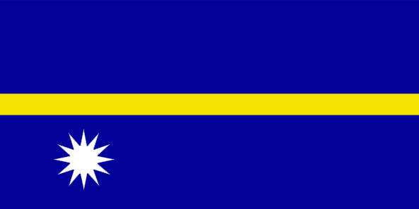
maplink
nrcolor.gif
outlinemaplink
nr.gif
visapassenger
-1
maincities
Anabar, Anibare, Anna, Ijuw, Uaboe, Yangor.
largestcity
Yaren District
largestcitypopulation
10 000
rankpopulation
220
Population
12 809
rankgni
205
gni
140000000
rankincomeorigin
48
rankincome
52
income
11667
lifeexpectation
62.33
natalityrate
0.02561
mortalityrate
0.00695
mortalityrateinfantile
0.01014
urbanization
1
nationalevent
Independence Day
nationaleventfr
Jour de l'Indépendance
nationalholiday
31 January (1968)
Date de naissance aaaa-mm-jj
1968-01-31 00:00:00
5
9
location
Oceania, island in the South Pacific Ocean, south of the Marshall Islands
terrain
sandy beach rises to fertile ring around raised coral reefs with phosphate plateau in center
naturalresources
phosphates, fish
9
rgbback
16777215
todate
1
169
id
Pays
Pays en Anglais
Navassa Island
Pays
Ile Navassa
countryucasefr
ILE NAVASSA
Pays en Chinois
Pays en Espagnol
Isla De Navassa
Pays en Italien
Isola Di Navassa
Pays en Portugais
Console De Navassa
Pays en Allemand
Insel Navassa
countryfull
Navassa Island
countrynm
Navassa Island
ISO2
UMI5
ISO3
UMI5
countrycodeisono
581
countrycodeirs
BQ
countrycodeirsfr
BQ
countrycodeirsmixt
BQ
♀Féminin
17
7
57
1
currencypxcode
USD
Superficie km2
5,20
arealand
5,20
coastline
8
timezonedeltabegin
-5
flaglink
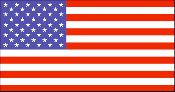
maplink
bq-map.gif
visapassenger
-1
rankincome
222
location
Caribbean, island in the Caribbean Sea, about one-fourth of the way from Haiti to Jamaica
terrain
raised coral and limestone plateau, flat to undulating; ringed by vertical white cliffs (9 to 15 m high)
naturalresources
guano
cooking
Caribbean, island in the Caribbean Sea, about one-fourth of the way from Haiti to Jamaica
9
rgbback
16777215
todate
1
170
id
Pays
Pays en Anglais
Nepal
Pays
Népal
countryucasefr
NEPAL
Pays en Chinois
Pays en Espagnol
Nepal
Pays en Italien
Il Nepal
Pays en Portugais
Nepal
Pays en Allemand
Nepal
countrypy
ni2 bo2 er3
countrylocal
Nepal
countryfull
Nepal
countrynm
Nepal
ISO2
NP
ISO3
NPL
countrycodeisono
524
countrycodevehicle
NEP
countrycodeolympic
NEP
countrycodeirs
NP
countrycodeirsfr
NP
countrycodeirsmixt
NP
♂Masulin
18
6
107
languagesfr
Nepali
73
currency
rupee
currencyfr
roupie népalaise
currencyisocode
NPR
currencyisocodefull
NPR 524
currencypxcode
NPR
currencysymbol
NRs
currencysubdivision
100 paise
currencyregime
composite
currencyvalue
0.01505
nationalityfr
Népalaise
Capitale
Kathmandu
capitalfr
Katmandou
Préfixe Tél.
977
Superficie km2
140 791
arealand
136 800
areawater
4 000
landarablerate
0.2027
landforestrate
0.273
summit
Everest 8 850 m.
boundarycountries
Inde, Chine.
timezonedeltabegin
5.75
flaglink
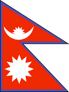
maplink
npcolor.gif
outlinemaplink
npout.gif
visapassenger
-1
maincities
Sallyana, Patan, Jumla, Biratnagar, Lalitpur, Bhaktapur, Pokhara.
largestcity
Kathmandu
largestcitypopulation
533 000
rankpopulation
44
Population
24 660 000
rankgdp
113
gdp
5851000000
rankgdpppp
78
gdpppp
35015000000
rankgni
113
gni
5868000000
rankincomeorigin
192
rankincome
206
income
240
rankincomeppp
179
incomeppp
1420
lifeexpectation
59
alphabetizationrate
0.3816
natalityrate
0.03246
mortalityrate
0.00984
mortalityrateinfantile
0.07057
hdi
0.49
nationalevent
Birthday of King GYANENDRA
nationaleventfr
Anniversaire du Roi GYANENDRA
nationalholiday
7 July (1946)
Date de naissance aaaa-mm-jj
1946-07-07 00:00:00
3
11
location
Southern Asia, between China and India
terrain
Terai or flat river plain of the Ganges in south, central hill region, rugged Himalayas in north
naturalresources
quartz, water, timber, hydropower, scenic beauty,
cooking
Encens spirituels.
9
rgbback
16777215
todate
1
Notes
Encens spirituels.
| Pays/Territoires | Régions en Chine | Provinces de Chine | Régions en France | Départements de France | Provinces du Monde | Villes/Villages | Localités | Continents du Monde | Vins AOP
