Pays/Territoires
Mise à jour 2021-01-12 18:58:56
Les noms des pays/territoires du monde sont donnés en Français et Chinois. Cette collection des précieuses terres fermes du monde que toute l'humanité partage inclut non seulement les pays indépendants, mais aussi des régions spécifiques qui ne sont pas membre de l'ONUOrganisation des Nations Unies: Nous, peuples des Nations Unies ... Une ONU plus forte pour un monde meilleur. Veuillez aussi consulter les noms des pays en masculin et féminin en Français.
GéoPays Fermer
181
id
Pays
Pays en Anglais
Northern Mariana Islands
Pays
Mariannes (îles de)
countryucasefr
MARIANNES (ILES DE)
Pays en Chinois
Pays en Espagnol
Islas De Mariana Norteñas
Pays en Italien
Isole Di Mariana Del Nord
Pays en Portugais
Consoles De Mariana Do norte
Pays en Allemand
NordcMarianacInseln
countryfull
Northern Mariana Islands
countrynm
Northern Mariana Islands
ISO2
MP
ISO3
MNP
countrycodeisono
580
countrycodeirs
CQ
countrycodeirsfr
CQ
countrycodeirsmixt
CQ
♀Féminin
12
6
51
1
currencypxcode
USD
Capitale
Saipan
capitalfr
Saipan
Préfixe Tél.
1-670
Superficie km2
477
arealand
477
landarablerate
0.1522
landforestrate
0.304
coastline
1482
timezonedeltabegin
10
flaglink
maplink
nmarmap.gif
visapassenger
-1
largestcity
Saipan
rankpopulation
193
Population
76 000
rankincome
222
nationalevent
Commonwealth Day
nationaleventfr
Jour du Commonwealth
nationalholiday
8 January (1978)
Date de naissance aaaa-mm-jj
1978-01-08 00:00:00
4
6
location
Oceania, islands in the North Pacific Ocean, about three-quarters of the way from Hawaii to the Philippines
terrain
southern islands are limestone with level terraces and fringing coral reefs; northern islands are volcanic
naturalresources
arable land, fish
cooking
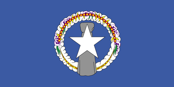
The islands, which include Saipan, Rota, Farallon de Pajaros and Tinian, total some 477 square kilometers. Saipan and Tinian have the best ports and harbors. Download high resolution version (992x496, 124 KB)Large flag of the Northern Mariana Islands. ... Image taken from www. ... Flag ratio: 1:2 The flag of the Northern Mariana Islands was adopted on July 4, 1976. ... A motto is a phrase or collection of words intended to describe the motivation or intention of a sociological grouping or organization. ... locator map for the Northern Marianas - made for Wikipedia File links The following pages link to this file: Northern Mariana Islands User:DanielZm/test Roman Catholic Diocese of Chalan Kanoa Categories: Country locator maps | Northern Mariana Islands | GFDL images ... As with any complex, emergent concept, language is somewhat resistant to definition. ... The English language is a West Germanic language that originates in England. ... Chamorro, or Chamoru, is the native language used in Guam and Northern Mariana Islands. ... Carolinian is an Austronesian language spoken in the Northern Mariana Islands, where it is an official language along with English and Chamorro. ... In politics a capital (also called capital city or political capital — although the latter phrase has an alternative meaning based on an alternative meaning of capital) is the principal city or town associated with its government. ... Saipan is the largest island and capital of the Northern Mariana Islands of the western Pacific Ocean, with a total area of 120 km² (46. ... A head of state or chief of state is the chief public representative of a nation-state, federation or commonwealth, whose role generally includes personifying the continuity and legitimacy of the state and exercising the political powers, functions and duties granted to the head of state in the countrys... List of Northern Mariana Islands Governors Carlos S. Camacho Democrat 1978-1982 Pedro P. Tenorio Republican 1982-1990 Lorenzo I. De Leon Guerrero Republican 1990-1994 Froilan C. Tenorio Democrat 1994-1998 Pedro P. Tenorio Republican 1998-2002 Juan N. Babauta Republican 2002- Categories: Lists of governors of U.S... Juan Nekai Babauta (born September 7, 1953, Tapanag, Saipan) is current governor of the Northern Mariana Islands. ... This article explains the meaning of area as a physical quantity. ... Here is a list of the countries of the world sorted by area. ... (Redirected from 1 E8 m2) To help compare different orders of magnitude and geographical regions, we list here areas between 100 km² and 1000 km². See also areas of other orders of magnitude. ... Square kilometre (US spelling: Square kilometer), symbol km², is an SI unit of surface area. ... In the most common sense of the word, a population is the collection of people—or organisms of a particular species—living in a given geographic area. ... Population density can be used as a measurement of any tangible item. ... This is a list of sovereign states and other territories by population. ... Independence is autonomous self-government of a country by its residents and indigenous population. ... The dollar is the name of the official currency in several countries, dependencies and other regions (see list below), including the US dollar, the worlds most widely circulated currency (see list below). ... -1... UTC also stands for the University of Tennessee at Chattanooga Coordinated Universal Time or UTC, also sometimes referred to as Zulu time, the basis for civil time, differs by an integral number of seconds from atomic time and a fractional number of seconds from UT1. ... The National Anthem is the name of a song by the band Radiohead. ... A top-level domain (TLD) is the last part of which Internet domain names consist of. ... .mp is the Internet country code top-level domain ( ccTLD) for Northern Mariana Islands. ... Saipan is the largest island and capital of the Northern Mariana Islands of the western Pacific Ocean, with a total area of 120 km² (46. ... Rota, also known as the peaceful island, is the southernmost island of the United States Commonwealth of the Northern Mariana Islands (CNMI). ... Farallon de Pajaros (from spanish Farallón de los pájaros, meaning Birds Rock), also known as Uracas (from Spanish Urracas, meaning Ravens), is the westernmost island in the Northern Mariana Islands chain. ... Tinian is one of the three principal islands of the Commonwealth of the Northern Marianas Islands. ... (Redirected from 1 E8 m2) To help compare different orders of magnitude and geographical regions, we list here areas between 100 km² and 1000 km². See also areas of other orders of magnitude. ...
9
rgbback
16777215
todate
1
182
id
Pays
Pays en Anglais
Norway
Pays
Norvège
countryucasefr
NORVEGE
Pays en Chinois
Pays en Espagnol
Noruega
Pays en Italien
La Norvegia
Pays en Portugais
Noruega
Pays en Allemand
Norwegen
countrypy
nuo2 wei1
countrylocal
Norge
countryfull
Norway
countrynm
Norway
ISO2
NO
ISO3
NOR
countrycodeisono
578
countrycodevehicle
N
countrycodeolympic
NOR
countrycodeirs
NO
countrycodeirsfr
NO
countrycodeirsmixt
NO
countrycode
47
♀Féminin
1
12
6
110
languagesfr
Norvégien
78
currency
krone (pl. kroner)
currencyfr
krone
currencyisocode
NOK
currencyisocodefull
NOK 578
currencypxcode
NOK
currencysymbol
NKr
currencysubdivision
100 øre
currencyregime
float
currencyvalue
0.1546
nationalityfr
Norvégienne
Capitale
Oslo
capitalfr
Oslo
Préfixe Tél.
47
Superficie km2
324 219
arealand
307 860
areawater
16 360
landarablerate
0.0294
landforestrate
0.289
coastline
21925
summit
Glittertinden 2 472 m.
boundarycountries
Suède, Finlande, Russie.
timezonedeltabegin
1
flaglink
maplink
nocolor.gif
outlinemaplink
no.gif
visapassenger
-1
maincities
Bergen, Trondheim, Stavanger, Kristianstad, Drammen, Tromsø, Alesund, Bodø, Skien, Fredrikstad.
largestcity
Oslo
largestcitypopulation
702 000
rankpopulation
113
Population
4 562 000
rankgdp
22
gdp
220854000000
rankgdpppp
41
gdpppp
171850000000
rankgni
23
gni
197991000000
rankincomeorigin
3
rankincome
2
income
43400
rankincomeppp
3
incomeppp
37910
lifeexpectation
79.25
alphabetizationrate
1
natalityrate
0.01189
mortalityrate
0.00951
mortalityrateinfantile
0.00373
hdi
0.944
urbanization
0.776
precipitation
763
nationalevent
Constitution Day
nationaleventfr
Jour de la Constitution
nationalholiday
17 May (1814)
Date de naissance aaaa-mm-jj
1814-05-17 00:00:00
1
11
location
Northern Europe, bordering the North Sea and the North Atlantic Ocean, west of Sweden
terrain
glaciated; mostly high plateaus and rugged mountains broken by fertile valleys; small, scattered plains; coastline deeply indented by fjords; arctic tundra in north
naturalresources
petroleum, copper, natural gas, pyrites, nickel, i
cooking
Saumons Sauvages.
7
Web
rgbback
16777215
todate
1
Notes
Saumons Sauvages.
183
id
Pays
Pays en Anglais
Oman
Pays
Oman
countryucasefr
OMAN
Pays en Chinois
Pays en Espagnol
Omán
Pays en Italien
L'Oman
Pays en Portugais
Oman
Pays en Allemand
Oman
countrypy
a1 man4
countrylocal
Saltanat Uman
countryfull
Oman
countrynm
Oman
ISO2
OM
ISO3
OMN
countrycodeisono
512
countrycodeolympic
OMA
countrycodeirs
MU
countrycodeirsfr
MU
countrycodeirsmixt
MU
1
3
3
languagesfr
Arabe
79
currency
rial
currencyfr
riyal d'Oman
currencyisocode
OMR
currencyisocodefull
OMR 512
currencypxcode
OMR
currencysymbol
RO
currencysubdivision
1,000 baizas
currencyregime
US-$ (1/2.6)
currencyvalue
2.5976
Capitale
Muscat
capitalfr
Mascate
Préfixe Tél.
968
Superficie km2
212 460
arealand
212 460
landarablerate
0.0008
coastline
2092
summit
Jabal ash-Sham 3 035 m
boundarycountries
Yémen, Arabie Saoudite, Emirats Arabes Unis.
timezonedeltabegin
4
flaglink
maplink
omcolor.gif
outlinemaplink
omout.gif
visapassenger
-1
maincities
Duqm, Salalah, Sur, Matrah, Nizwa
largestcity
Muscat
largestcitypopulation
635 000
rankpopulation
136
Population
2 599 000
rankgdp
69
gdp
20309000000
rankgdpppp
80
gdpppp
33859000000
rankgni
69
gni
19877000000
rankincomeorigin
59
rankincome
64
income
7830
rankincomeppp
62
incomeppp
13000
lifeexpectation
72.85
alphabetizationrate
0.737
natalityrate
0.03712
mortalityrate
0.00391
mortalityrateinfantile
0.02026
hdi
0.755
urbanization
0.765
nationalevent
Birthday of Sultan QABOOS
nationaleventfr
Anniversaire du Sultan QABOOS
nationalholiday
18 November (1940)
Date de naissance aaaa-mm-jj
1940-11-18 00:00:00
7
5
location
Middle East, bordering the Arabian Sea, Gulf of Oman, and Persian Gulf, between Yemen and UAE
terrain
central desert plain, rugged mountains in north and south
naturalresources
petroleum, copper, asbestos, some marble, limeston
9
Web
rgbback
16777215
todate
1
184
id
Pays
Pays en Anglais
Pakistan
Pays
Pakistan
countryucasefr
PAKISTAN
Pays en Chinois
Pays en Espagnol
Paquistán
Pays en Italien
Il Pakistan
Pays en Portugais
Paquistão
Pays en Allemand
Pakistan
countrypy
ba1 ji1 si1 tan3
countrylocal
Pakistan
countryfull
Pakistan
countrynm
Pakistan
ISO2
PK
ISO3
PAK
countrycodeisono
586
countrycodevehicle
PK
countrycodeolympic
PAK
countrycodeirs
PK
countrycodeirsfr
PK
countrycodeirsmixt
PK
♂Masulin
4
183
languagesfr
Ourdou
80
currency
rupee
currencyfr
roupie pakistanaise
currencyisocode
PKR
currencyisocodefull
PKR 586
currencypxcode
PKR
currencysymbol
Rs
currencysubdivision
100 paisa
currencyregime
m.float
currencyvalue
0.01679
nationalityfr
Pakistanaise
Capitale
Islamabad
capitalfr
Islamabad
Préfixe Tél.
92
Superficie km2
803 943
arealand
778 720
areawater
25 220
landarablerate
0.2781
landforestrate
0.031
coastline
1046
summit
Goldwin Austen 8 611 m.
boundarycountries
Iran, Afghanistan, Chine, Inde.
timezonedeltabegin
5
flaglink
maplink
pkcolor.gif
outlinemaplink
pkout.gif
visapassenger
-1
maincities
Karachi, Lahore, Faisalabad, Rawalpindi, Hyderabad, Multan, Gujranwala, Peshawar, Sialkot, Sargodha.
largestcity
Islamabad
largestcitypopulation
9 733 000
rankpopulation
6
Population
148 439 000
rankgdp
43
gdp
82324000000
rankgdpppp
25
gdpppp
311258000000
rankgni
44
gni
77575000000
rankincomeorigin
161
rankincome
175
income
520
rankincomeppp
159
incomeppp
2040
lifeexpectation
62.2
alphabetizationrate
0.348
natalityrate
0.02959
mortalityrate
0.00879
mortalityrateinfantile
0.07653
precipitation
218
nationalevent
Republic Day
nationaleventfr
Jour de la République
nationalholiday
23 March (1956)
Date de naissance aaaa-mm-jj
1956-03-23 00:00:00
3
9
location
Southern Asia, bordering the Arabian Sea, between India on the east and Iran and Afghanistan on the west and China in the north
terrain
flat Indus plain in east; mountains in north and northwest; Balochistan plateau in west
naturalresources
land, extensive natural gas reserves, limited petr
9
Web
rgbback
16777215
todate
1
185
id
Pays
Pays en Anglais
Palmyra Atoll
Pays
Atoll Palmyra
countryucasefr
ATOLL PALMYRA
Pays en Chinois
Pays en Espagnol
Palmyra Atoll
Pays en Italien
Palmyra Atoll
Pays en Portugais
Palmyra Atoll
Pays en Allemand
Palmyra Atoll
countryfull
Palmyra Atoll
countrynm
Palmyra Atoll
ISO2
UMI4
ISO3
UMI4
countrycodeisono
581
countrycodeirs
LQ
countrycodeirsfr
LQ
countrycodeirsmixt
LQ
♂Masulin
17
7
51
1
currencypxcode
USD
Superficie km2
12
arealand
11,90
coastline
14.5
timezonedeltabegin
-11
flaglink
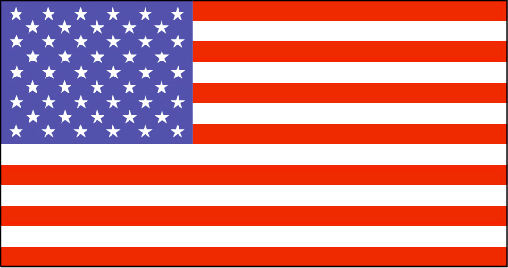
maplink
lq-map.gif
visapassenger
-1
rankincome
222
location
Oceania, atoll in the North Pacific Ocean, about half way between Hawaii and American Samoa
terrain
very low
naturalresources
terrestrial and aquatic wildlife
cooking
Oceania, atoll in the North Pacific Ocean, about half way between Hawaii and American Samoa
9
rgbback
16777215
todate
1
186
id
Pays
Pays en Anglais
Panama
Pays
Panama
countryucasefr
PANAMA
Pays en Chinois
Pays en Espagnol
Panamá
Pays en Italien
Il Panama
Pays en Portugais
Panamá
Pays en Allemand
Panama
countrypy
ba1 na2 ma3
countrylocal
Panama
countryfull
Panama
countrynm
Panama
ISO2
PA
ISO3
PAN
countrycodeisono
591
countrycodevehicle
PA
countrycodeolympic
PAN
countrycodeirs
PM
countrycodeirsfr
PM
countrycodeirsmixt
PM
countrycode
507
19
6
131
languagesfr
Espagnol
81
currency
balboa
currencyfr
balboa
currencyisocode
PAB
currencyisocodefull
PAB 590
currencypxcode
PAB
currencysymbol
B
currencysubdivision
100 centesimos
currencyregime
US-$ (1.0)
currencyvalue
1.005
nationalityfr
Panamienne
Capitale
Panama City
capitalfr
Panama
Préfixe Tél.
507
Superficie km2
78 046
arealand
75 990
areawater
2 210
landarablerate
0.0672
landforestrate
0.386
coastline
2490
summit
Volcán de Chiriquí 3 475 m.
boundarycountries
Costa Rica, Colombie.
timezonedeltabegin
-5
flaglink
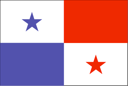
maplink
pacolor.gif
outlinemaplink
paoutl.gif
visapassenger
-1
maincities
David, La Chorrera, Santiago, Tocumen, Colón.
largestcity
Panama City
largestcitypopulation
967 000
rankpopulation
133
Population
2 984 000
rankgdp
85
gdp
12887000000
rankgdpppp
99
gdpppp
20452000000
rankgni
85
gni
12127000000
rankincomeorigin
79
rankincome
87
income
4060
rankincomeppp
96
incomeppp
6420
lifeexpectation
72.14
alphabetizationrate
0.9235
natalityrate
0.02036
mortalityrate
0.00639
mortalityrateinfantile
0.02095
hdi
0.788
urbanization
0.565
nationalevent
Independence Day
nationaleventfr
Jour de l'Indépendance
nationalholiday
3 November (1903)
Date de naissance aaaa-mm-jj
1903-11-03 00:00:00
10
4
location
Middle America, bordering both the Caribbean Sea and the North Pacific Ocean, between Colombia and Costa Rica
terrain
interior mostly steep, rugged mountains and dissected, upland plains; coastal areas largely plains and rolling hills
naturalresources
copper, mahogany forests, shrimp, hydropower
9
Web
rgbback
16777215
todate
1
187
id
Pays
Pays en Anglais
Papua New Guinea
Pays
Papouasie-Nouvelle-Guinée
countryucasefr
PAPOUASIE-NOUVELLE-GUINEE
Pays en Chinois
Pays en Espagnol
Papua Nueva Guinea
Pays en Italien
La Papuasia Nuova Guinea
Pays en Portugais
Papua Nova Guiné
Pays en Allemand
Papua Neu-Guinea
countrypy
ba1 bu4 ya4 xin1 ji3 nei4 ya4
countrylocal
Papua Niu Gini
countryfull
Papua New Guinea
countrynm
Papua New Guinea
ISO2
PG
ISO3
PNG
countrycodeisono
598
countrycodevehicle
PNG
countrycodeolympic
PNG
countrycodeirs
PP
countrycodeirsfr
PP
countrycodeirsmixt
PP
♀Féminin
12
6
51
languagesfr
Anglais
152
currency
kina
currencyfr
kina
currencyisocode
PGK
currencyisocodefull
PGK 598
currencypxcode
PGK
currencysymbol
K
currencysubdivision
100 toeas
currencyregime
composite
currencyvalue
0.321
Capitale
Port Moresby
capitalfr
Port-Moresby
Préfixe Tél.
675
Superficie km2
461 691
arealand
452 860
areawater
9 980
landarablerate
0.0013
landforestrate
0.676
coastline
5152
summit
Mount Wilhelm 4 694 m.
boundarycountries
Indonésie.
timezonedeltabegin
10
flaglink
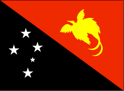
maplink
pgcolor.gif
outlinemaplink
pg.gif
visapassenger
-1
maincities
Lae, Madang, Wewak, Goroka, Rabaul, Mount Hagen.
largestcity
Port Moresby
largestcitypopulation
247 000
rankpopulation
102
Population
5 502 000
rankgdp
133
gdp
3182000000
rankgdpppp
109
gdpppp
14408000000
rankgni
144
gni
2753000000
rankincomeorigin
163
rankincome
177
income
500
rankincomeppp
153
incomeppp
2250
lifeexpectation
64.56
alphabetizationrate
0.658
natalityrate
0.03052
mortalityrate
0.0075
mortalityrateinfantile
0.05315
hdi
0.548
urbanization
0.176
nationalevent
Independence Day
nationaleventfr
Jour de l'Indépendance
nationalholiday
16 September (1975)
Date de naissance aaaa-mm-jj
1975-09-16 00:00:00
2
4
location
Oceania, group of islands including the eastern half of the island of New Guinea between the Coral Sea and the South Pacific Ocean, east of Indonesia
terrain
mostly mountains with coastal lowlands and rolling foothills
naturalresources
gold, copper, silver, natural gas, timber, oil, fi
9
rgbback
16777215
todate
1
188
id
Pays
Pays en Anglais
Paracel Islands
Pays
Iles Paracel
countryucasefr
ILES PARACEL
Pays en Chinois
Pays en Espagnol
Islas De Paracel
Pays en Italien
Isole Di Paracel
Pays en Portugais
Consoles De Paracel
Pays en Allemand
Inseln Paracel
countryfull
Paracel Islands
countrynm
Paracel Islands
ISO2
CHNP
ISO3
CHNP
countrycodeisono
156
countrycodeolympic
CHN
countrycodeirs
PF
countrycodeirsfr
PF
countrycodeirsmixt
PF
♀Féminin
5
1
126
3
Préfixe Tél.
86
coastline
518
timezonedeltabegin
8
flaglink
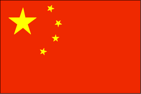
maplink
pf-map.gif
visapassenger
-1
rankincome
222
location
Southeastern Asia, group of small islands and reefs in the South China Sea, about one-third of the way from central Vietnam to the northern Philippines
terrain
mostly low and flat
naturalresources
none
cooking
Southeastern Asia, group of small islands and reefs in the South China Sea, about one-third of the way from central Vietnam to the northern Philippines
9
rgbback
16777215
todate
1
189
id
Pays
Pays en Anglais
Paraguay
Pays
Paraguay
countryucasefr
PARAGUAY
Pays en Chinois
Pays en Espagnol
Paraguay
Pays en Italien
Il Paraguay
Pays en Portugais
Paraguai
Pays en Allemand
Paraguay
countrypy
ba1 la1 gui1
countrylocal
Paraguay
countryfull
Paraguay
countrynm
Paraguay
ISO2
PY
ISO3
PRY
countrycodeisono
600
countrycodevehicle
PY
countrycodeolympic
PAR
countrycodeirs
PA
countrycodeirsfr
PA
countrycodeirsmixt
PA
countrycode
595
♂Masulin
15
6
131
languagesfr
Guarani, Espagnol
82
currency
guarani
currencyfr
guarani
currencyisocode
PYG
currencyisocodefull
PYG 600
currencypxcode
PYG
currencysymbol
slashed G
currencysubdivision
100 centimos [*]
currencyregime
float
currencyvalue
0.00016
nationalityfr
Paraguayenne
Capitale
Asuncion
capitalfr
Asuncion
Préfixe Tél.
595
Superficie km2
406 750
arealand
397 300
areawater
9 450
landarablerate
0.0554
landforestrate
0.588
summit
Cerro San Rafael 850 m.
boundarycountries
Bolivie, Brésil, Argentine.
timezonedeltabegin
-4
flaglink
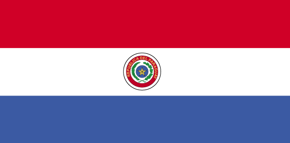
maplink
pycolor.gif
outlinemaplink
py.gif
visapassenger
-1
maincities
Puerto Strossner, Encarnación, Ciudad del Este, San Lorenzo, Pedro Juan Caballero, Concepción, Fernando de la Mora, Pilar, Villarrica, Coronel Oviedo.
largestcity
Asuncion
largestcitypopulation
1 081 000
rankpopulation
100
Population
5 643 000
rankgdp
112
gdp
6030000000
rankgdpppp
90
gdpppp
26430000000
rankgni
110
gni
6273000000
rankincomeorigin
132
rankincome
144
income
1110
rankincomeppp
127
incomeppp
4690
lifeexpectation
74.64
alphabetizationrate
0.937
natalityrate
0.02978
mortalityrate
0.00458
mortalityrateinfantile
0.02667
hdi
0.751
urbanization
0.567
precipitation
1333
nationalevent
Independence Day
nationaleventfr
Jour de l'Indépendance
nationalholiday
14 May (1811)
Date de naissance aaaa-mm-jj
1811-05-14 00:00:00
8
8
location
Central South America, northeast of Argentina
terrain
grassy plains and wooded hills east of Rio Paraguay; Gran Chaco region west of Rio Paraguay mostly low, marshy plain near the river, and dry forest and thorny scrub elsewhere
naturalresources
hydropower, timber, iron ore, manganese, limestone
9
Web
rgbback
16777215
todate
1
190
id
Pays
Pays en Anglais
Peru
Pays
Pérou
countryucasefr
PEROU
Pays en Chinois
Pays en Espagnol
Perú
Pays en Italien
Il Perù
Pays en Portugais
Peru
Pays en Allemand
Peru
countrypy
bi4 lu3
countrylocal
Peru
countryfull
Peru
countrynm
Peru
ISO2
PE
ISO3
PER
countrycodeisono
604
countrycodevehicle
PE
countrycodeolympic
PER
countrycodeirs
PE
countrycodeirsfr
PE
countrycodeirsmixt
PE
countrycode
51
♂Masulin
15
6
131
languagesfr
Espagnol, Quechua
83
currency
new sol
currencyfr
sol
currencyisocode
PEN
currencyisocodefull
PEN 604
currencypxcode
PEN
currencysymbol
S/.
currencysubdivision
100 centimos
currencyregime
float
currencyvalue
0.3073
nationalityfr
Péruvienne
Capitale
Lima
capitalfr
Lima
Préfixe Tél.
51
Superficie km2
1 285 216
arealand
1 280 000
areawater
5 220
landarablerate
0.0285
landforestrate
0.509
coastline
2414
summit
Nevado Huascarán 6 768 m.
boundarycountries
Equateur, Colombie, Brésil, Bolivie, Chili.
timezonedeltabegin
-5
flaglink
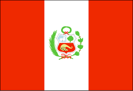
maplink
pecolor.gif
outlinemaplink
pe.gif
visapassenger
-1
maincities
Arequipa, Lambayeque, Trujillo, Chiclayo, Callao, Chimbote, Piura, Cuzco, Huancayo, Iquitos, Sullana, Pucallpa
largestcity
Lima
largestcitypopulation
6 667 000
rankpopulation
38
Population
27 148 000
rankgdp
51
gdp
60577000000
rankgdpppp
50
gdpppp
142791000000
rankgni
50
gni
58179000000
rankincomeorigin
106
rankincome
116
income
2140
rankincomeppp
117
incomeppp
5080
lifeexpectation
70.88
alphabetizationrate
0.851
natalityrate
0.02281
mortalityrate
0.00569
mortalityrateinfantile
0.03697
hdi
0.743
precipitation
6
nationalevent
Independence Day
nationaleventfr
Jour de l'Indépendance
nationalholiday
28 July (1821)
Date de naissance aaaa-mm-jj
1821-07-28 00:00:00
8
6
location
Western South America, bordering the South Pacific Ocean, between Chile and Ecuador
terrain
western coastal plain (costa), high and rugged Andes in center (sierra), eastern lowland jungle of Amazon Basin (selva)
naturalresources
copper, silver, gold, petroleum, timber, fish, iro
cooking
Fruits exotiques.
9
Web
rgbback
16777215
todate
1
Notes
Fruits exotiques.
| Pays/Territoires | Régions en Chine | Provinces de Chine | Régions en France | Départements de France | Provinces du Monde | Villes/Villages | Localités | Continents du Monde | Vins AOP
