Pays/Territoires
Mise à jour 2021-01-12 18:58:56
Les noms des pays/territoires du monde sont donnés en Français et Chinois. Cette collection des précieuses terres fermes du monde que toute l'humanité partage inclut non seulement les pays indépendants, mais aussi des régions spécifiques qui ne sont pas membre de l'ONUOrganisation des Nations Unies: Nous, peuples des Nations Unies ... Une ONU plus forte pour un monde meilleur. Veuillez aussi consulter les noms des pays en masculin et féminin en Français.
GéoPays Fermer
241
id
Pays
Pays en Anglais
Tromelin Island
Pays
Ile de Tromelin
countryucasefr
ILE DE TROMELIN
Pays en Chinois
Pays en Espagnol
Isla De Tromelin
Pays en Italien
Isola Di Tromelin
Pays en Portugais
Console De Tromelin
Pays en Allemand
Insel Tromelin
countryfull
Tromelin Island
countrynm
Tromelin Island
ISO2
REUT
ISO3
REUT
countrycodeisono
638
countrycodeirs
TE
countrycodeirsfr
TE
countrycodeirsmixt
TE
♀Féminin
15
6
57
2
currencypxcode
EUR
Capitale
Saint Denis
capitalfr
Saint Denis
Préfixe Tél.
262
Superficie km2
1
arealand
1
coastline
3.7
timezonedeltabegin
4
flaglink
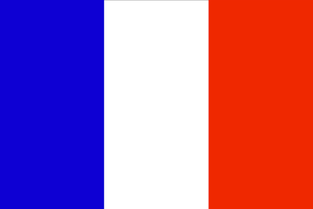
maplink
te-map.gif
visapassenger
-1
largestcity
Saint Denis
rankincome
222
location
Southern Africa, island in the Indian Ocean, east of Madagascar
terrain
low, flat, and sandy; likely volcanic
naturalresources
fish
cooking
Southern Africa, island in the Indian Ocean, east of Madagascar
9
rgbback
16777215
todate
1
242
id
Pays
Pays en Anglais
Trust Territory of Pacific Islands
Pays
Trust Territory of Pacific Islands
countryucasefr
TRUST TERRITORY OF PACIFIC ISLANDS
Pays en Chinois
Pays en Espagnol
Territorio de la confianza de las islas pacíficas
Pays en Italien
Territorio di fiducia delle isole pacifiche
Pays en Portugais
Território da confiança de consoles pacíficos
Pays en Allemand
Vertrauensgegend von pazifischen Inseln
countryfull
Trust Territory of Pacific Islands
countrynm
Trust Territory of Pacific Islands
ISO2
UM
ISO3
UMI
countrycodeisono
581
countrycodeirs
PS
countrycodeirsfr
PS
countrycodeirsmixt
UM
♀Féminin
17
7
51
1
currencypxcode
USD
Capitale
Koror
capitalfr
Koror
Superficie km2
458
timezonedeltabegin
11
flaglink
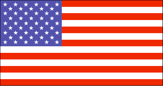
maplink
trustpacific.gif
visapassenger
-1
largestcity
Koror
Population
16 071
rankincome
222
cooking
Pacific Islands, Trust Territory of the, former trust territory in the western Pacific Ocean that was administered by the United States. The stars in the flag represented the Mariana Islands, Marshall Islands, Ponape, Truk, Yap, and Palau.
9
rgbback
16777215
todate
1
243
id
Pays
Pays en Anglais
Tunisia
Pays
Tunisie
countryucasefr
TUNISIE
Pays en Chinois
Pays en Espagnol
Túnez
Pays en Italien
La Tunisia
Pays en Portugais
Tunísia
Pays en Allemand
Tunesien
countrypy
tu1 ni2 xi1 ya4
countrylocal
Tunis
countryfull
Tunisia
countrynm
Tunisia
ISO2
TN
ISO3
TUN
countrycodeisono
788
countrycodevehicle
TN
countrycodeolympic
TUN
countrycodeirs
TS
countrycodeirsfr
TS
countrycodeirsmixt
TS
countrycode
216
♀Féminin
15
4
3
languagesfr
Arabe
161
currency
dinar
currencyfr
dinar tunisien
currencyisocode
TND
currencyisocodefull
TND 788
currencypxcode
TND
currencysymbol
TD
currencysubdivision
1,000 millimes
currencyregime
m.float (1.0)
currencyvalue
0.7685
nationalityfr
Tunisienne
Capitale
Tunis
capitalfr
Tunis
Préfixe Tél.
216
Superficie km2
163 610
arealand
155 360
areawater
8 250
landarablerate
0.1867
landforestrate
0.031
coastline
1148
summit
Jabal ash Sha'ambi 1 544 m.
boundarycountries
Algérie, Libye.
timezonedeltabegin
1
flaglink
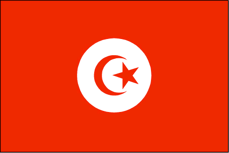
maplink
tncolor.gif
outlinemaplink
tnout.gif
visapassenger
-1
maincities
Sfax, Bizerte, Djerba, Gabès, Sousse, Kairouan, Gafsa.
largestcity
Tunis
largestcitypopulation
1 722 000
rankpopulation
77
Population
9 895 000
rankgdp
65
gdp
25037000000
rankgdpppp
60
gdpppp
70863000000
rankgni
68
gni
22204000000
rankincomeorigin
103
rankincome
113
income
2240
rankincomeppp
92
incomeppp
6850
lifeexpectation
72.9
alphabetizationrate
0.753
natalityrate
0.0169
mortalityrate
0.0055
mortalityrateinfantile
0.0228
precipitation
466
nationalevent
Independence Day
nationaleventfr
Jour de l'Indépendance
nationalholiday
20 March (1956)
Date de naissance aaaa-mm-jj
1956-03-20 00:00:00
3
9
location
Northern Africa, bordering the Mediterranean Sea, between Algeria and Libya
terrain
mountains in north; hot, dry central plain; semiarid south merges into the Sahara
naturalresources
petroleum, phosphates, iron ore, lead, zinc, salt
cooking
Couscous.
7
Web
rgbback
16777215
todate
1
Notes
Couscous.
244
id
Pays
Pays en Anglais
Turkey
Pays
Turquie
countryucasefr
TURQUIE
Pays en Chinois
Pays en Espagnol
Turquía
Pays en Italien
La Turchia
Pays en Portugais
Turquia
Pays en Allemand
Die Türkei
countrypy
tu3 er3 qi2
countrylocal
Turkiye
countryfull
Turkey
countrynm
Turkey
ISO2
TR
ISO3
TUR
countrycodeisono
792
countrycodevehicle
TR
countrycodeolympic
TUR
countrycodeirs
TU
countrycodeirsfr
TU
countrycodeirsmixt
TU
countrycode
90
♀Féminin
18
6
166
languagesfr
Turc
105
currency
new lira
currencyfr
livre turque
currencyisocode
TRY
currencyisocodefull
TRY 949
currencypxcode
TRY
currencysymbol
YTL
currencysubdivision
100 new kurus
currencyregime
float
currencyvalue
0.74129
nationalityfr
Turque
Capitale
Ankara
capitalfr
Ankara
Préfixe Tél.
90
Superficie km2
780 576
arealand
770 760
areawater
9 820
landarablerate
0.3453
landforestrate
0.133
coastline
7200
summit
Büyük Agri Dagi 5 185 m.
boundarycountries
Grèce, Bulgarie, Géorgie, Arménie, Azerbaïdjan, Iran, Irak, Syrie.
timezonedeltabegin
2
flaglink
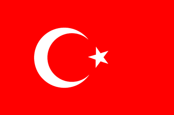
maplink
treunewl.gif
outlinemaplink
tr.gif
visapassenger
-1
maincities
Istanbul, Izmir, Adana, Bursa, Gaziantep, Konya, Kayseri, Eskisehir, Mersin, Diyarbakir.
largestcity
Istanbul
largestcitypopulation
7 911 000
rankpopulation
15
Population
70 712 000
rankgdp
21
gdp
240376000000
rankgdpppp
17
gdpppp
478891000000
rankgni
24
gni
197788000000
rankincomeorigin
93
rankincome
103
income
2800
rankincomeppp
94
incomeppp
6710
lifeexpectation
71.8
alphabetizationrate
0.8144
natalityrate
0.01759
mortalityrate
0.00595
mortalityrateinfantile
0.0442
precipitation
697
nationalevent
Independence Day
nationaleventfr
Jour de l'Indépendance
nationalholiday
29 October (1923)
Date de naissance aaaa-mm-jj
1923-10-29 00:00:00
10
12
location
southeastern Europe and southwestern Asia (that portion of Turkey west of the Bosporus is geographically part of Europe), bordering the Black Sea, between Bulgaria and Georgia, and bordering the Aegean Sea and the Mediterranean Sea, between Greece and Syr
terrain
high central plateau (Anatolia); narrow coastal plain; several mountain ranges
naturalresources
antimony, coal, chromium, mercury, copper, borate,
7
Web
rgbback
16777215
todate
1
245
id
Pays
Pays en Anglais
Turkmenistan
Pays
Turkménistan
countryucasefr
TURKMENISTAN
Pays en Chinois
Pays en Espagnol
Turkmenistan
Pays en Italien
Turkmenistan
Pays en Portugais
Turkmenistan
Pays en Allemand
Turkmenistan
countrypy
tu3 ku4 man4
countrylocal
Turkmenistan
countryfull
Turkmenistan
countrynm
Turkmenistan
ISO2
TM
ISO3
TKM
countrycodeisono
795
countrycodevehicle
TM
countrycodeolympic
TKM
countrycodeirs
TX
countrycodeirsfr
TX
countrycodeirsmixt
TX
♂Masulin
15
1
201
languagesfr
Turkmen
162
currency
manat
currencyfr
rouble
currencyisocode
TMM
currencyisocodefull
TMM 795
currencypxcode
TMM
currencysubdivision
100 tenga
currencyregime
US-$ (10.0;230.0)
nationalityfr
Turkmen
Capitale
Ashgabat
capitalfr
Achkhabad
Préfixe Tél.
993
Superficie km2
488 100
arealand
488 100
landarablerate
0.0347
landforestrate
0.08
summit
Ayrybaba 3 189 m.
boundarycountries
Iran, Kazakhstan, Ouzbekistan, Afghanistan.
timezonedeltabegin
5
flaglink
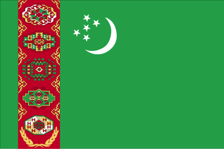
maplink
tmcolor.gif
outlinemaplink
tmout.gif
visapassenger
-1
maincities
Chardzhou, Tashauz, Krasnovodsk
largestcity
Ashkhabad
largestcitypopulation
462 000
rankpopulation
111
Population
4 864 000
rankgdp
109
gdp
6201000000
rankgdpppp
86
gdpppp
28881000000
rankgni
116
gni
5442000000
rankincomeorigin
131
rankincome
143
income
1120
rankincomeppp
106
incomeppp
5860
lifeexpectation
61.29
alphabetizationrate
0.98
natalityrate
0.02782
mortalityrate
0.00882
mortalityrateinfantile
0.07313
hdi
0.748
urbanization
0.449
precipitation
227
nationalevent
Independence Day
nationaleventfr
Jour de l'Indépendance
nationalholiday
27 October (1991)
Date de naissance aaaa-mm-jj
1991-10-27 00:00:00
8
8
location
Central Asia, bordering the Caspian Sea, between Iran and Kazakhstan
terrain
flat-to-rolling sandy desert with dunes rising to mountains in the south; low mountains along border with Iran; borders Caspian Sea in west
naturalresources
petroleum, natural gas, coal, sulfur, salt
9
Web
rgbback
16777215
todate
1
246
id
Pays
Pays en Anglais
Turks and Caicos Islands
Pays
Turks et Caicos (îles)
countryucasefr
TURKS ET CAICOS (ILES)
Pays en Chinois
Pays en Espagnol
Turcos e islas de Caicos
Pays en Italien
Turchi ed isole del Caicos
Pays en Portugais
Turks e consoles de Caicos
Pays en Allemand
Türken und Caicosinseln
countryfull
Turks and Caicos Islands
countrynm
Turks and Caicos Islands
ISO2
TC
ISO3
TCA
countrycodeisono
796
countrycodeirs
TK
countrycodeirsfr
TK
countrycodeirsmixt
TK
♀Féminin
12
6
51
6
currency
dollar
currencyfr
dollar des Caraïbes orientales
currencyisocode
USD
currencyisocodefull
USD 840
currencypxcode
USD
currencysymbol
$
currencysubdivision
100 cents
currencyregime
float
currencyvalue
1
Capitale
Grand Turk
capitalfr
Grand Turk
Préfixe Tél.
1-649
Superficie km2
430
arealand
430
landarablerate
0.0233
coastline
389
timezonedeltabegin
-5
flaglink
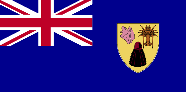
maplink
tccolor.gif
outlinemaplink
tc.gif
visapassenger
-1
largestcity
Grand Turk
rankpopulation
217
Population
17 502
rankgni
208
gni
120000000
rankincomeorigin
67
rankincome
71
income
7059
nationalevent
Constitution Day
nationaleventfr
Jour de la Constitution
nationalholiday
30 August (1976)
Date de naissance aaaa-mm-jj
1976-08-30 00:00:00
3
5
location
Caribbean, two island groups in the North Atlantic Ocean, southeast of The Bahamas, north of Haiti
terrain
low, flat limestone; extensive marshes and mangrove swamps
naturalresources
spiny lobster, conch
9
rgbback
16777215
todate
1
247
id
Pays
Pays en Anglais
Tuvalu
Pays
Tuvalu
countryucasefr
TUVALU
Pays en Chinois
Pays en Espagnol
Tuvalu
Pays en Italien
Tuvalu
Pays en Portugais
Tuvalu
Pays en Allemand
Tuvalu
countrypy
tu3 wa3 lu3
countryfull
Tuvalu
countrynm
Tuvalu
ISO2
TV
ISO3
TUV
countrycodeisono
798
countrycodeolympic
TUV
countrycodeirs
TV
countrycodeirsfr
TV
countrycodeirsmixt
TV
♂Masulin
12
6
51
languagesfr
Anglais
10
currency
dollar
currencyfr
dollar australien
currencyisocode
AUD
currencyisocodefull
AUD 036
currencypxcode
AUD
currencysymbol
A$
currencysubdivision
100 cents
currencyregime
float
currencyvalue
0.7485
Capitale
Funafuti
capitalfr
Funafuti
Préfixe Tél.
688
Superficie km2
26
arealand
26
coastline
24
summit
5 m.
timezonedeltabegin
12
flaglink
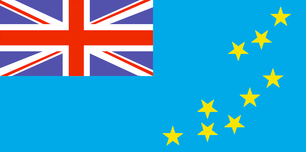
maplink
tvcolor.gif
outlinemaplink
tv.gif
visapassenger
-1
largestcity
Funafuti
rankpopulation
221
Population
10 838
rankgni
216
gni
20000000
rankincomeorigin
120
rankincome
129
income
1818
lifeexpectation
67.66
alphabetizationrate
0.55
natalityrate
0.02163
mortalityrate
0.00724
mortalityrateinfantile
0.02069
urbanization
0.532
nationalevent
Independence Day
nationaleventfr
Jour de l'Indépendance
nationalholiday
1 October (1978)
Date de naissance aaaa-mm-jj
1978-10-01 00:00:00
5
7
president
Reine Elisabeth II
location
Oceania, island group consisting of nine coral atolls in the South Pacific Ocean, about one-half of the way from Hawaii to Australia
terrain
very low-lying and narrow coral atolls
naturalresources
fish
9
rgbback
16777215
todate
1
248
id
Pays
Pays en Anglais
Uganda
Pays
Ouganda
countryucasefr
OUGANDA
Pays en Chinois
Pays en Espagnol
Uganda
Pays en Italien
L'Uganda
Pays en Portugais
Uganda
Pays en Allemand
Uganda
countrypy
wu1 gan1 da2
countrylocal
Uganda
countryfull
Uganda
countrynm
Uganda
ISO2
UG
ISO3
UGA
countrycodeisono
800
countrycodevehicle
EAU
countrycodeolympic
UGA
countrycodeirs
UG
countrycodeirsfr
UG
countrycodeirsmixt
UG
♂Masulin
15
4
51
languagesfr
Anglais
163
currency
shilling
currencyfr
shilling ougandais
currencyisocode
UGX
currencyisocodefull
UGX 800
currencypxcode
UGS
currencysymbol
USh
currencysubdivision
100 cents
currencyregime
float
currencyvalue
0.00057
nationalityfr
Ugandaise
Capitale
Kampala
capitalfr
Kampala
Préfixe Tél.
256
Superficie km2
236 040
arealand
199 710
areawater
36 330
landarablerate
0.2534
landforestrate
0.21
summit
Margherita Peak 5 109 m.
boundarycountries
Congo démocratique, Soudan, Kenya, Tanzanie, Rwanda.
timezonedeltabegin
3
flaglink
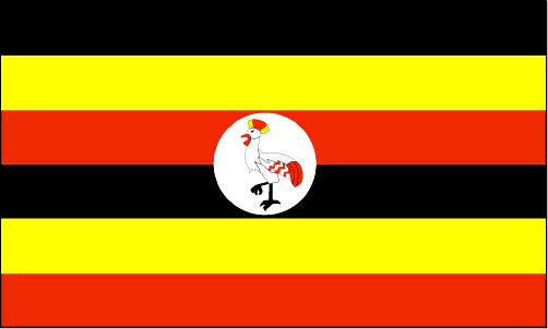
maplink
ugcolor.gif
outlinemaplink
ugout.gif
visapassenger
-1
maincities
Jinja, Masaka, Mbale, Mbarara, Entebbe, Tororo, Gulu, Fort Portal.
largestcity
Kampala
largestcitypopulation
954 000
rankpopulation
41
Population
25 280 000
rankgdp
108
gdp
6297000000
rankgdpppp
77
gdpppp
36827000000
rankgni
111
gni
6244000000
rankincomeorigin
191
rankincome
205
income
250
rankincomeppp
178
incomeppp
1430
lifeexpectation
44.88
alphabetizationrate
0.5397
natalityrate
0.04657
mortalityrate
0.01695
mortalityrateinfantile
0.0879
hdi
0.444
nationalevent
Independence Day
nationaleventfr
Jour de l'Indépendance
nationalholiday
9 October (1962)
Date de naissance aaaa-mm-jj
1962-10-09 00:00:00
9
3
location
Eastern Africa, west of Kenya
terrain
mostly plateau with rim of mountains
naturalresources
copper, cobalt, hydropower, limestone, salt, arabl
9
Web
rgbback
16777215
todate
1
249
id
Pays
Pays en Anglais
Ukraine
Pays
Ukraine
countryucasefr
UKRAINE
Pays en Chinois
Pays en Espagnol
Ucrania
Pays en Italien
L'Ucraina
Pays en Portugais
Ucrânia
Pays en Allemand
Ukraine
countrypy
wu1 ke4 lan2
countrylocal
Ukrayina
countryfull
Ukraine
countrynm
Ukraine
ISO2
UA
ISO3
UKR
countrycodeisono
804
countrycodevehicle
UA
countrycodeolympic
UKR
countrycodeirs
UP
countrycodeirsfr
UP
countrycodeirsmixt
UP
♀Féminin
15
6
168
languagesfr
Ukrainien
108
currency
Hryvnia
currencyfr
Hyrvnia
currencyisocode
UAH
currencyisocodefull
UAH 980
currencypxcode
UAH
currencysubdivision
100 kopiykas
currencyregime
float
currencyvalue
0.1976
nationalityfr
Ukrainienne
Capitale
Kiev
capitalfr
Kiev
Préfixe Tél.
380
Superficie km2
603 700
arealand
603 700
landarablerate
0.571
landforestrate
0.165
coastline
2782
summit
Gora Goverla 2 061 m.
boundarycountries
Roumanie, Moldavie, Hongrie, Slovaquie, Pologne, Biélorussie, Russie.
timezonedeltabegin
2
flaglink
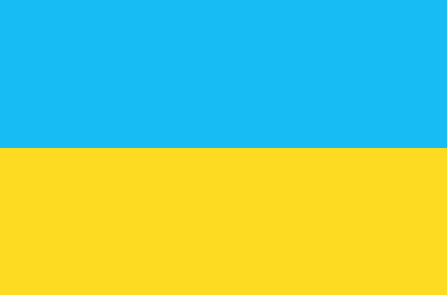
maplink
up-map.gif
outlinemaplink
ua.gif
visapassenger
-1
maincities
Dniepropetrovsk, Odessa, Kharkhov, Donetsk, Zaporozh'ye, L'viv, Krivoy Rog, Marioupol, Nikolaïev, Lugansk, Makeyevka, Vinnitsa, Sebastopol, Khersan, Simferopol, Gorlovka.
largestcity
Kiev
largestcitypopulation
2 812 000
rankpopulation
25
Population
48 356 000
rankgdp
55
gdp
49537000000
rankgdpppp
30
gdpppp
265534000000
rankgni
54
gni
46739000000
rankincomeorigin
137
rankincome
148
income
970
rankincomeppp
112
incomeppp
5430
lifeexpectation
66.5
alphabetizationrate
1
natalityrate
0.00989
mortalityrate
0.01639
mortalityrateinfantile
0.02087
hdi
0.766
precipitation
649
nationalevent
Independence Day
nationaleventfr
Jour de l'Indépendance
nationalholiday
24 August (1991)
Date de naissance aaaa-mm-jj
1991-08-24 00:00:00
8
8
location
Eastern Europe, bordering the Black Sea, between Poland and Russia
terrain
most of Ukraine consists of fertile plains (steppes) and plateaus, mountains being found only in the west (the Carpathians), and in the Crimean Peninsula in the extreme south
naturalresources
iron ore, coal, manganese, natural gas, oil, salt,
7
Web
rgbback
16777215
todate
1
250
id
Pays
Pays en Anglais
United Arab Emirates
Pays
Emirats Arabes Unis
countryucasefr
EMIRATS ARABES UNIS
Pays en Chinois
Pays en Espagnol
Emiratos Árabes Unidos
Pays en Italien
Gli Emirati Arabi Uniti
Pays en Portugais
Emirates Árabes Unidos
Pays en Allemand
Vereinigte Arabische Emirates
countrypy
a1 la1 bo2 lian2 he2 qiu2 chang2 guo2
countrylocal
Al Imarat al Arabiyah al Muttahidah
countryfull
United Arab Emirates
countrynm
United Arab Emirates
ISO2
AE
ISO3
ARE
countrycodeisono
784
countrycodeolympic
UAE
countrycodeirs
TC
countrycodeirsfr
TC
countrycodeirsmixt
TC
countrycode
971
♂Masulin
12
3
3
languagesfr
Arabe
164
currency
dirham
currencyfr
dirham
currencyisocode
AED
currencyisocodefull
AED 784
currencypxcode
AED
currencysymbol
Dh
currencysubdivision
100 fils
currencyregime
US-$ (lim.flex.)
currencyvalue
0.2723
Capitale
Abu Dhabi
capitalfr
Abu Zabi
Préfixe Tél.
971
Superficie km2
75 581
arealand
82 880
landarablerate
0.0048
landforestrate
0.038
coastline
1318
summit
Jabal Yibir 1 527 m.
boundarycountries
Arabie Saoudite, Qatar, Oman.
timezonedeltabegin
4
flaglink
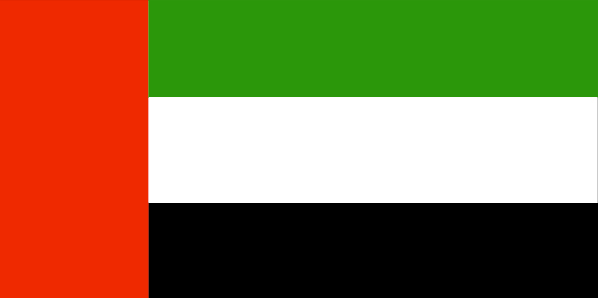
maplink
aecolor.gif
outlinemaplink
aeout.gif
visapassenger
-1
maincities
Dubai, Sharjah, Ras al Khaimah, Fujairah.Dubai, Sharjah, Ras al Khaimah, Fujairah.
largestcity
Abu Dhabi
largestcitypopulation
799 000
rankpopulation
120
Population
4 041 000
rankgdp
48
gdp
70960000000
rankgni
44
gni
66300000000
rankincomeorigin
24
rankincome
26
income
20097
rankincomeppp
38
incomeppp
20920
lifeexpectation
74.99
alphabetizationrate
0.7825
natalityrate
0.01865
mortalityrate
0.00414
mortalityrateinfantile
0.01506
hdi
0.816
urbanization
0.872
precipitation
89
nationalevent
Independence Day
nationaleventfr
Jour de l'Indépendance
nationalholiday
2 December (1971)
Date de naissance aaaa-mm-jj
1971-12-02 00:00:00
8
12
location
Middle East, bordering the Gulf of Oman and the Persian Gulf, between Oman and Saudi Arabia
terrain
flat, barren coastal plain merging into rolling sand dunes of vast desert wasteland; mountains in east
naturalresources
petroleum, natural gas
9
Web
rgbback
16777215
todate
1
| Pays/Territoires | Régions en Chine | Provinces de Chine | Régions en France | Départements de France | Provinces du Monde | Villes/Villages | Localités | Continents du Monde | Vins AOP
