Pays/Territoires
Mise à jour 2021-01-12 18:58:56
Les noms des pays/territoires du monde sont donnés en Français et Chinois. Cette collection des précieuses terres fermes du monde que toute l'humanité partage inclut non seulement les pays indépendants, mais aussi des régions spécifiques qui ne sont pas membre de l'ONUOrganisation des Nations Unies: Nous, peuples des Nations Unies ... Une ONU plus forte pour un monde meilleur. Veuillez aussi consulter les noms des pays en masculin et féminin en Français.
GéoPays Fermer
261
id
Pays
Pays en Anglais
Wake Island
Pays
Ile Wake
countryucasefr
ILE WAKE
Pays en Chinois
Pays en Espagnol
Isla De la Estela
Pays en Italien
Isola Di Risveglio
Pays en Portugais
Console Da Vigília
Pays en Allemand
SpurcInsel
countryfull
Wake Island
countrynm
Wake Island
ISO2
UMI1
ISO3
UMI1
countrycodeisono
581
countrycodeirs
WQ
countrycodeirsfr
WQ
countrycodeirsmixt
WQ
♀Féminin
17
7
57
6
currency
dollar
currencyisocode
USD
currencyisocodefull
USD 840
currencypxcode
USD
currencysymbol
$
currencysubdivision
100 cents
currencyregime
float
currencyvalue
1
Superficie km2
6,50
arealand
6,50
coastline
19.3
timezonedeltabegin
12
flaglink
maplink
wake.gif
visapassenger
-1
rankincome
222
location
Oceania, atoll in the North Pacific Ocean, about two-thirds of the way from Hawaii to the Northern Mariana Islands
terrain
atoll of three coral islands built up on an underwater volcano; central lagoon is former crater, islands are part of the rim
naturalresources
none
cooking
Oceania, atoll in the North Pacific Ocean, about two-thirds of the way from Hawaii to the Northern Mariana Islands
9
rgbback
16777215
todate
1
262
id
Pays
Pays en Anglais
Wallis and Futuna
Pays
Wallis et Futuna
countryucasefr
WALLIS ET FUTUNA
Pays en Chinois
Pays en Espagnol
Wallis y Futuna
Pays en Italien
Wallis e Futuna
Pays en Portugais
Wallis e Futuna
Pays en Allemand
Wallis und Futuna
countryfull
Wallis and Futuna
countrynm
Wallis and Futuna
ISO2
WF
ISO3
WLF
countrycodeisono
876
countrycodeirs
WF
countrycodeirsfr
WF
countrycodeirsmixt
WF
♂Masulin
15
6
57
2
currency
franc
currencyisocode
XPF
currencyisocodefull
XPF 953
currencypxcode
XPF
currencysubdivision
100 centimes
currencyregime
Euro (119.253)
currencyvalue
0.01025
Capitale
Mata-Utu
capitalfr
Mata-Utu
Préfixe Tél.
681
Superficie km2
274
arealand
274
landarablerate
0.05
coastline
129
timezonedeltabegin
12
flaglink
maplink
wallisf.gif
outlinemaplink
wf.gif
visapassenger
-1
largestcity
Mata-Utu
rankpopulation
218
Population
15 283
rankgni
211
gni
60000000
rankincomeorigin
87
rankincome
90
income
4000
nationalevent
Bastille Day
nationaleventfr
Jour de la prise de la Bastille
nationalholiday
14 July (1789)
Date de naissance aaaa-mm-jj
1789-07-14 00:00:00
6
10
location
Oceania, islands in the South Pacific Ocean, about two-thirds of the way from Hawaii to New Zealand
terrain
volcanic origin; low hills
naturalresources
NEGL
9
rgbback
16777215
todate
1
263
id
Pays
Pays en Anglais
West Bank
Pays
West Bank
countryucasefr
WEST BANK
Pays en Chinois
Pays en Espagnol
Banco Del oeste
Pays en Italien
La Banca Ad ovest
Pays en Portugais
Banco Ocidental
Pays en Allemand
WestcBank
countryfull
West Bank
countrynm
West Bank
ISO2
PSEW
ISO3
PSEW
countrycodeisono
275
countrycodeolympic
PLE
countrycodeirs
WE
countrycodeirsfr
WE
countrycodeirsmixt
WE
♂Masulin
7
2
3
151
currencypxcode
NZD
nationalityfr
Paléstinienne
Capitale
Ramala
capitalfr
Ramala
Préfixe Tél.
970
Superficie km2
3 000
arealand
5 640
areawater
220
timezonedeltabegin
2
flaglink
maplink
westbankmaplg.jpg
visapassenger
-1
largestcity
Ramala
rankpopulation
130
Population
3 367 000
rankgdp
132
gdp
3454000000
rankgni
133
gni
3734000000
rankincomeorigin
132
rankincome
144
income
1110
location
Middle East, west of Jordan
terrain
mostly rugged dissected upland, some vegetation in west, but barren in east
naturalresources
arable land
9
rgbback
16777215
todate
1
264
id
Pays
Pays en Anglais
Yemen
Pays
Yémen
countryucasefr
YEMEN
Pays en Chinois
Pays en Espagnol
Yemen
Pays en Italien
Il Yemen
Pays en Portugais
Yemen
Pays en Allemand
Yemen
countrypy
ye3 men2
countrylocal
Al Yaman
countryfull
Yemen
countrynm
Yemen
ISO2
YE
ISO3
YEM
countrycodeisono
887
countrycodevehicle
YAR
countrycodeolympic
YEM
countrycodeirs
YM
countrycodeirsfr
YM
countrycodeirsmixt
YE
♂Masulin
15
6
3
languagesfr
Arabe
113
currency
rial
currencyfr
Rial
currencyisocode
YER
currencyisocodefull
YER 886
currencypxcode
YER
currencysymbol
YRls
currencysubdivision
100 fils
currencyregime
float
currencyvalue
0.00546
nationalityfr
Yémenoise
Capitale
Sanaa
capitalfr
Sanaa
Préfixe Tél.
967
Superficie km2
527 970
arealand
527 970
landarablerate
0.0275
landforestrate
0.009
coastline
1906
summit
Jabal an Nabi Shu'ayb 3 760 m.
boundarycountries
Arabie Saoudite, Oman.
timezonedeltabegin
3
flaglink
maplink
yecolor.gif
outlinemaplink
yeout.gif
visapassenger
-1
maincities
Aden, Ta'izz, Hodeïah, Dhamar, Al Mukalla, Hajjah, Al Bayda.
largestcity
Sanaa
largestcitypopulation
1 937 050
rankpopulation
51
Population
19 173 000
rankgdp
90
gdp
10831000000
rankgdpppp
103
gdpppp
17044000000
rankgni
94
gni
9894000000
rankincomeorigin
161
rankincome
175
income
520
rankincomeppp
196
incomeppp
820
lifeexpectation
60.97
alphabetizationrate
0.385
natalityrate
0.04323
mortalityrate
0.00904
mortalityrateinfantile
0.06502
hdi
0.479
nationalevent
Unification Day
nationaleventfr
Jour de l'Unification
nationalholiday
22 May (1990)
Date de naissance aaaa-mm-jj
1990-05-22 00:00:00
7
7
location
Middle East, bordering the Arabian Sea, Gulf of Aden, and Red Sea, between Oman and Saudi Arabia
terrain
narrow coastal plain backed by flat-topped hills and rugged mountains; dissected upland desert plains in center slope into the desert interior of the Arabian Peninsula
naturalresources
petroleum, fish, rock salt, marble, small deposits
9
Web
rgbback
16777215
todate
1
265
id
Pays
Pays en Anglais
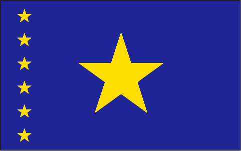
Congo, Democratic
Pays
Congo Démocratique
countryucasefr
CONGO (REPUBLIQUE DEMOCRATIQUE DU)
Pays en Chinois
Pays en Espagnol
Zaire
Pays en Italien
Lo Zaire
Pays en Portugais
Zaire
Pays en Allemand
Zaire
countrypy
gang1 guo3 min2 zhu3 gong4 he2 guo2
countrylocal
République Démocratique du Congo
countryfull
Congo, Democratic Republic of the
countrynm
Congo, Democratic Republic of the
ISO2
CD
ISO3
COD
countrycodeisono
180
countrycodevehicle
ZRE
countrycodeolympic
COD
countrycodeirs
CG
countrycodeirsfr
CG
countrycodeirsmixt
CG
♂Masulin
3
2
57
languagesfr
Français
132
currency
franc
currencyfr
zaïre
currencyisocode
CDF
currencyisocodefull
CDF 180
currencypxcode
CDF
currencysubdivision
100 centimes
currencyregime
US-$ (2.50)
nationalityfr
Congolaise
Capitale
Kinshasa
capitalfr
Kinshasa
Préfixe Tél.
243
Superficie km2
2 345 410
arealand
2 267 600
areawater
77 810
landarablerate
0.0296
landforestrate
0.596
coastline
37
summit
Pic Marguerite 5 109 m.
boundarycountries
Congo, Centrafrique, Soudan, Ouganda, Rwanda, Burundi, Tanzanie, Zambie, Angola.
timezonedeltabegin
1
flaglink
maplink
cdcolor.gif
outlinemaplink
cdout.gif
visapassenger
-1
maincities
Lubumbashi, Mbuji Mayi, Kananga, Kisangani, Likasi, Kalémié, Bukavu, Kamina, Kikwit, Matadi, Mbandaka.
largestcity
Brazzaville
largestcitypopulation
1 004 000
rankpopulation
23
Population
53 153 000
rankgdp
114
gdp
5671000000
rankgdpppp
76
gdpppp
37026000000
rankgni
117
gni
5425000000
rankincomeorigin
206
rankincome
219
income
100
rankincomeppp
204
incomeppp
660
lifeexpectation
49.14
alphabetizationrate
0.6435
natalityrate
0.04473
mortalityrate
0.01464
mortalityrateinfantile
0.09469
hdi
0.363
nationalevent
Independence Day
nationaleventfr
Jour de l'Indépendance
nationalholiday
30 June (1960)
Date de naissance aaaa-mm-jj
1960-06-30 00:00:00
7
1
location
Central Africa, northeast of Angola
terrain
vast central basin is a low-lying plateau; mountains in east
naturalresources
cobalt, copper, cadmium, petroleum, industrial and
9
Web
rgbback
16777215
todate
1
266
id
Pays
Pays en Anglais
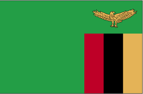
Zambia
Pays
Zambie
countryucasefr
ZAMBIE
Pays en Chinois
Pays en Espagnol
Zambia
Pays en Italien
Lo Zambia
Pays en Portugais
Zâmbia
Pays en Allemand
Sambia
countrypy
zan4 bi3 ya4
countrylocal
Zambia
countryfull
Zambia
countrynm
Zambia
ISO2
ZM
ISO3
ZMB
countrycodeisono
894
countrycodevehicle
RNR
countrycodeolympic
ZAM
countrycodeirs
ZA
countrycodeirsfr
ZA
countrycodeirsmixt
ZA
♀Féminin
15
6
51
languagesfr
Anglais
115
currency
kwacha
currencyfr
kwacha
currencyisocode
ZMK
currencyisocodefull
ZMK 894
currencypxcode
ZMK
currencysymbol
ZK
currencysubdivision
100 ngwee
currencyregime
float
currencyvalue
0.00022
nationalityfr
Zambienne
Capitale
Lusaka
capitalfr
Lusaka
Préfixe Tél.
260
Superficie km2
752 614
arealand
740 724
areawater
11 890
landarablerate
0.0708
landforestrate
0.42
summit
Mafinga Hills 2 301 m.
boundarycountries
Angola, Congo démocratique, Tanzanie, Malawi, Mozambique, Zimbabwe, Botswana, Namibie.
timezonedeltabegin
2
flaglink
maplink
zmcolor.gif
outlinemaplink
zmout.gif
visapassenger
-1
maincities
Kitwe-Nkana, Ndola, Kabwe, Mufulira, Chingola, Luanshya, Livingstone, Kalulushi, Chilabombwe.
largestcity
Lusaka
largestcitypopulation
2 141 875
rankpopulation
72
Population
10 403 000
rankgdp
121
gdp
4335000000
rankgdpppp
126
gdpppp
9120000000
rankgni
129
gni
3982000000
rankincomeorigin
177
rankincome
191
income
380
rankincomeppp
194
incomeppp
850
lifeexpectation
35.18
alphabetizationrate
0.8
natalityrate
0.03899
mortalityrate
0.02435
mortalityrateinfantile
0.0984
hdi
0.386
urbanization
0.398
nationalevent
Independence Day
nationaleventfr
Jour de l'Indépendance
nationalholiday
24 October (1964)
Date de naissance aaaa-mm-jj
1964-10-24 00:00:00
1
5
location
Southern Africa, east of Angola
terrain
mostly high plateau with some hills and mountains
naturalresources
copper, cobalt, zinc, lead, coal, emeralds, gold,
9
Web
rgbback
16777215
todate
1
267
id
Pays
Pays en Anglais
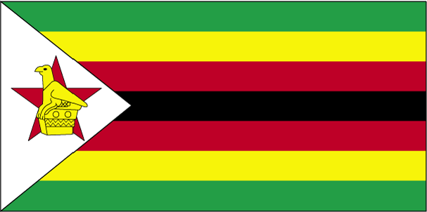
Zimbabwe
Pays
Zimbabwe
countryucasefr
ZIMBABWE
Pays en Chinois
Pays en Espagnol
Zimbabwe
Pays en Italien
Lo Zimbabwe
Pays en Portugais
Zimbabwe
Pays en Allemand
Zimbabwe
countrypy
xin1 ba1 wei1
countrylocal
Zimbabwe
countryfull
Zimbabwe
countrynm
Zimbabwe
ISO2
ZW
ISO3
ZWE
countrycodeisono
716
countrycodevehicle
ZW
countrycodeolympic
ZIM
countrycodeirs
ZI
countrycodeirsfr
ZI
countrycodeirsmixt
ZI
♂Masulin
18
4
51
languagesfr
Anglais
114
currency
dollar
currencyfr
dollar du Zimbabwe
currencyisocode
ZWD
currencyisocodefull
ZWD 716
currencypxcode
ZWD
currencysymbol
Z$
currencysubdivision
100 cents
currencyregime
float
currencyvalue
0.00011
Capitale
Harare
capitalfr
Harare
Préfixe Tél.
263
Superficie km2
390 580
arealand
386 670
areawater
3 910
landarablerate
0.084
landforestrate
0.492
summit
Inyangani 2 593 m
boundarycountries
Botswana, Zambie, Afrique du Sud, Mozambique
timezonedeltabegin
2
flaglink
maplink
zwcolor.gif
outlinemaplink
zwout.gif
visapassenger
-1
maincities
Bulawayo, Chitungwiza, Gwelo, Mutare, Que Que, Kadoma, Wankie, Masvingo, Shabani, Chegutu, Chinhoyi..
largestcity
Harare
largestcitypopulation
2 672 193
rankpopulation
62
Population
13 102 000
rankgdp
76
gdp
17750000000
rankgdpppp
84
gdpppp
30356000000
rankgni
106
gni
6165000000
rankincomeorigin
163
rankincome
178
income
480
rankincomeppp
156
incomeppp
2180
lifeexpectation
39.01
alphabetizationrate
0.8038
natalityrate
0.03034
mortalityrate
0.02202
mortalityrateinfantile
0.06647
nationalevent
Independence Day
nationaleventfr
Jour de l'Indépendance
nationalholiday
18 April (1980)
Date de naissance aaaa-mm-jj
1980-04-18 00:00:00
7
9
location
Southern Africa, between South Africa and Zambia
terrain
mostly high plateau with higher central plateau (high veld); mountains in east
naturalresources
coal, chromium ore, asbestos, gold, nickel, copper
9
Web
rgbback
16777215
todate
1
268
id
Pays
Pays en Anglais
ZZZ Other
Pays
ZZZ Autre
countryucasefr
ZZZ AUTRE
Pays en Chinois
Pays en Espagnol
ZZZ Otro
Pays en Italien
ZZZ Altro
Pays en Portugais
ZZZ Outro
Pays en Allemand
ZZZ Anderes
countryfull
ZZZ Other
countrynm
ZZZ Other
ISO2
ZZZ2
ISO3
ZZZ3
countrycodeirs
OC
countrycodeirsfr
OC
countrycodeirsmixt
OC
108
1
Capitale
New York
capitalfr
New York
timezonedeltabegin
-5
flaglink
maplink
worldcolors.gif
visapassenger
-1
largestcity
New York
rankincome
222
rgbback
16777215
todate
1
269
id
Pays
Pays en Anglais
Palau
Pays
Palaos
countryucasefr
PALAOS
Pays en Chinois
countryfull
Palau
countrynm
Palau
ISO2
PW
ISO3
PLW
countrycodeisono
585
countrycodeolympic
PLW
countrycodeirs
PW
countrycodeirsfr
PW
countrycodeirsmixt
PW
♂Masulin
19
6
51
languagesfr
Anglais
6
currency
dollar
currencyfr
Dollar
currencyisocode
USD
currencyisocodefull
USD 840
currencypxcode
USD
currencysymbol
$
currencysubdivision
100 cents
currencyregime
float
currencyvalue
1
Capitale
Koror
capitalfr
Koror
Préfixe Tél.
680
Superficie km2
494
arealand
458
landarablerate
0.2174
landforestrate
0.761
coastline
1519
summit
Mount Ngerchelchauus 242 m.
boundarycountries
Anies.
timezonedeltabegin
9
flaglink
maplink
palau.jpg
maincities
Anies
largestcity
Koror
largestcitypopulation
12 000
rankpopulation
207
Population
20 000
rankgdp
182
gdp
126000000
rankgni
206
gni
130000000
rankincomeorigin
66
rankincome
73
income
6500
nationalevent
Constitution Day
nationaleventfr
Jour de la Constitution
nationalholiday
9 July (1979)
Date de naissance aaaa-mm-jj
1979-07-09 00:00:00
6
8
location
Oceania, group of islands in the North Pacific Ocean, southeast of the Philippines
terrain
varying geologically from the high, mountainous main island of Babelthuap to low, coral islands usually fringed by large barrier reefs
naturalresources
forests, minerals (especially gold), marine produc
9
rgbback
16777215
todate
1
270
id
Pays
Pays en Anglais
Palestina
Pays
Paléstine
countryucasefr
PALESTINE
Pays en Chinois
countrypy
ba1 le4 si1 tan3
countrylocal
Filastin
countryfull
Palestine
countrynm
Palestine
ISO2
PS
ISO3
PSE
countrycodeisono
275
countrycodeolympic
PLE
countrycodeirs
PS
countrycodeirsfr
PS
countrycodeirsmixt
PS
♀Féminin
7
2
3
languagesfr
Ramala
151
currency
Dinar
currencyfr
Livre palestinienne
currencypxcode
ILS
nationalityfr
Paléstinienne
Capitale
Ramala
capitalfr
Ramala
Préfixe Tél.
970
Superficie km2
6 236
summit
Tail Asur 1 016 m.
boundarycountries
Egypte, Israël, Jordanie.
timezonedeltabegin
2
flaglink
maplink
palestine_map.gif
maincities
Naplouse, Jéricho, Hebron, Gaza, Bethléem, Ramallah.
largestcity
Ramala
rankpopulation
129
Population
3 152 361
gni
3340000000
rankincome
153
income
919
lifeexpectation
72.24
alphabetizationrate
0.843
natalityrate
0.03692
mortalityrate
0.00401
mortalityrateinfantile
0.02185
growthrate
0.04519
hdi
0.731
urbanization
0.671
9
rgbback
16777215
todate
1
| Pays/Territoires | Régions en Chine | Provinces de Chine | Régions en France | Départements de France | Provinces du Monde | Villes/Villages | Localités | Continents du Monde | Vins AOP
