Pays/Territoires
Mise à jour 2021-01-12 18:58:56
Les noms des pays/territoires du monde sont donnés en Français et Chinois. Cette collection des précieuses terres fermes du monde que toute l'humanité partage inclut non seulement les pays indépendants, mais aussi des régions spécifiques qui ne sont pas membre de l'ONUOrganisation des Nations Unies: Nous, peuples des Nations Unies ... Une ONU plus forte pour un monde meilleur. Veuillez aussi consulter les noms des pays en masculin et féminin en Français.
GéoPays Fermer
71
id
Pays
Pays en Anglais
Egypt
Pays
Egypte
countryucasefr
EGYPTE
Pays en Chinois
Pays en Espagnol
Egipto
Pays en Italien
L'Egitto
Pays en Portugais
Egipto
Pays en Allemand
Ägypten
countrypy
ai1 ji2
countrylocal
Misr
countryfull
Egypt
countrynm
Egypt
ISO2
EG
ISO3
EGY
countrycodeisono
818
countrycodevehicle
ET
countrycodeolympic
EGY
countrycodeirs
EG
countrycodeirsfr
EG
countrycodeirsmixt
EG
countrycode
20
♀Féminin
15
4
3
languagesfr
Arabe
36
currency
pound
currencyfr
livre égyptienne
currencyisocode
EGP
currencyisocodefull
EGP 818
currencypxcode
EGP
currencysymbol
£E
currencysubdivision
100 piasters or 1,000 milliemes
currencyregime
m.float
currencyvalue
0.173
nationalityfr
Egyptienne
Capitale
Cairo
capitalfr
Le Caire
Préfixe Tél.
20
Superficie km2
1 001 449
arealand
995 450
areawater
6 000
landarablerate
0.0285
landforestrate
0.001
coastline
2450
summit
Jabal Katrînah 2 642 m
boundarycountries
Libye, Israël, Palestine, Soudan.
timezonedeltabegin
2
flaglink
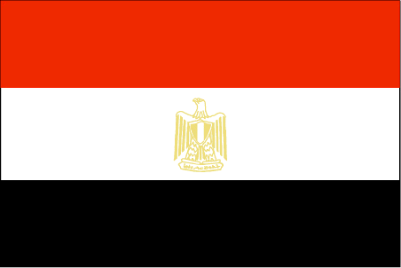
maplink
egcolor.gif
outlinemaplink
egout.gif
visapassenger
-1
maincities
Alexandrie, Ismaïlia, Gîza, Port Saïd, Assiout, Helwân, Tanta, El Mahlla el Kubra, Zagazig, El Mansoura, Suez, Assouan.
largestcity
Cairo
largestcitypopulation
9 690 000
rankpopulation
17
Population
67 559 000
rankgdp
42
gdp
82427000000
rankgdpppp
29
gdpppp
266853000000
rankgni
38
gni
93850000000
rankincomeorigin
126
rankincome
138
income
1390
rankincomeppp
132
incomeppp
3940
lifeexpectation
70.41
alphabetizationrate
0.484
natalityrate
0.02436
mortalityrate
0.00535
mortalityrateinfantile
0.03526
nationalevent
Revolution Day
nationaleventfr
Jour de le Révolution
nationalholiday
23 July (1952)
Date de naissance aaaa-mm-jj
1952-07-23 00:00:00
9
5
location
Northern Africa, bordering the Mediterranean Sea, between Libya and the Gaza Strip, and the Red Sea north of Sudan, and includes the Asian Sinai Peninsula
terrain
vast desert plateau interrupted by Nile valley and delta
naturalresources
petroleum, natural gas, iron ore, phosphates, mang
9
Web
rgbback
16777215
todate
1
72
id
Pays
Pays en Anglais
El Salvador
Pays
El Salvador
countryucasefr
EL SALVADOR
Pays en Chinois
Pays en Espagnol
Salvador De EL
Pays en Italien
Salvador Di EL
Pays en Portugais
Salvador De EL
Pays en Allemand
EL-Salvador
countrypy
sa4 er3 wa3 duo1
countrylocal
El Salvador
countryfull
El Salvador
countrynm
El Salvador
ISO2
SV
ISO3
SLV
countrycodeisono
222
countrycodevehicle
ES
countrycodeolympic
ESA
countrycodeirs
EL
countrycodeirsfr
EL
countrycodeirsmixt
EL
countrycode
503
♂Masulin
15
6
131
languagesfr
Espagnol
37
currency
colon
currencyfr
colon
currencyisocode
SVC
currencyisocodefull
SVC 222
currencypxcode
SVC
currencysymbol
¢
currencysubdivision
100 centavos
currencyregime
float
currencyvalue
0.1143
nationalityfr
Salvadorienne
Capitale
San Salvador
capitalfr
San Salvador
Préfixe Tél.
503
Superficie km2
21 041
arealand
20 720
areawater
320
landarablerate
0.2727
landforestrate
0.058
coastline
307
summit
Cerro El Pital 2 730 m.
boundarycountries
Guatémala, Honduras.
timezonedeltabegin
-6
flaglink
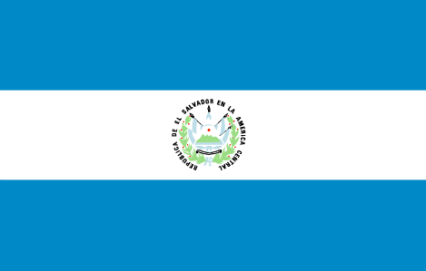
maplink
svcolor.gif
outlinemaplink
svoutl.gif
visapassenger
-1
maincities
Santa Ana, San Miguel, Nueva San Salvador, Sonsonate, Cojutepeque.
largestcity
San Salvador
largestcitypopulation
1 214 000
rankpopulation
97
Population
6 533 000
rankgdp
81
gdp
14879000000
rankgdpppp
83
gdpppp
31237000000
rankgni
82
gni
15282000000
rankincomeorigin
100
rankincome
110
income
2340
rankincomeppp
122
incomeppp
4910
lifeexpectation
70.92
alphabetizationrate
0.798
natalityrate
0.02748
mortalityrate
0.00593
mortalityrateinfantile
0.02593
hdi
0.729
urbanization
0.615
nationalevent
Independence Day
nationaleventfr
Jour de l'Indépendance
nationalholiday
15 September (1821)
Date de naissance aaaa-mm-jj
1821-09-15 00:00:00
8
6
location
Middle America, bordering the North Pacific Ocean, between Guatemala and Honduras
terrain
mostly mountains with narrow coastal belt and central plateau
naturalresources
hydropower, geothermal power, petroleum, arable la
9
Web
rgbback
16777215
todate
1
73
id
Pays
Pays en Anglais
Equatorial Guinea
Pays
Guinée équatoriale
countryucasefr
GUINEE EQUATORIALE
Pays en Chinois
Pays en Espagnol
Guinea Ecuatorial
Pays en Italien
Guinea Equatoriale
Pays en Portugais
Guinea Equatorial
Pays en Allemand
Äquatoriale Guine
countrypy
chi4 dao4 ji3 nei4 ya4
countrylocal
Guinea Ecuatorial
countryfull
Equatorial Guinea
countrynm
Equatorial Guinea
ISO2
GQ
ISO3
GNQ
countrycodeisono
226
countrycodeolympic
GEQ
countrycodeirs
EK
countrycodeirsfr
EK
countrycodeirsmixt
EK
♀Féminin
15
4
131
languagesfr
Espagnol
119
currency
franc
currencyfr
franc C.F.A.
currencyisocode
GQE
currencyisocodefull
GQE 226
currencypxcode
GQE
currencysymbol
CFAF
currencysubdivision
100 centimos
currencyregime
Euro (655.957)
nationalityfr
Guinéenne
Capitale
Malabo
capitalfr
Malabo
Préfixe Tél.
240
Superficie km2
28 051
arealand
28 051
landarablerate
0.0463
landforestrate
0.625
coastline
296
summit
Pico de Santa Isabel 3 008 m.
boundarycountries
Cameroun, Gabon.
timezonedeltabegin
1
flaglink
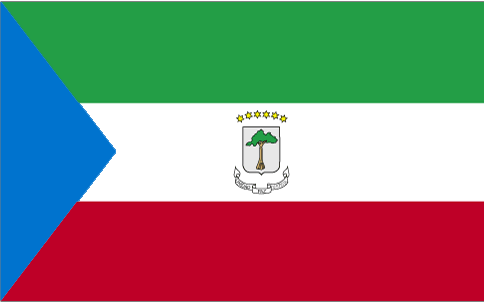
maplink
gqcolor.gif
outlinemaplink
gqout.gif
visapassenger
-1
maincities
Bata, Luba, Mbini, Evinayong, Ebebiyin, Mongono.
largestcity
Malabo
largestcitypopulation
30 000
rankpopulation
161
Population
494 000
rankgdp
135
gdp
2915000000
rankgdpppp
128
gdpppp
8988000000
rankgni
195
gni
327000000
rankincomeorigin
150
rankincome
165
income
700
rankincomeppp
116
incomeppp
5100
lifeexpectation
55.15
alphabetizationrate
0.85
natalityrate
0.03656
mortalityrate
0.01227
mortalityrateinfantile
0.08708
hdi
0.664
urbanization
0.493
nationalevent
Independence Day
nationaleventfr
Jour de l'Indépendance
nationalholiday
12 October (1968)
Date de naissance aaaa-mm-jj
1968-10-12 00:00:00
5
9
location
Western Africa, bordering the Bight of Biafra, between Cameroon and Gabon
terrain
coastal plains rise to interior hills; islands are volcanic
naturalresources
oil, petroleum, timber, small unexploited deposits
9
Web
rgbback
16777215
todate
1
74
id
Pays
Pays en Anglais
Eritrea
Pays
Erythrée
countryucasefr
ERYTHREE
Pays en Chinois
Pays en Espagnol
Eritrea
Pays en Italien
Eritrea
Pays en Portugais
Eritrea
Pays en Allemand
Eritrea
countrypy
e4 li4 te4 li3 ya4
countrylocal
Hagere Ertra
countryfull
Eritrea
countrynm
Eritrea
ISO2
ER
ISO3
ERI
countrycodeisono
232
countrycodeolympic
ERI
countrycodeirs
ER
countrycodeirsfr
ER
countrycodeirsmixt
ER
♀Féminin
7
1
3
languagesfr
Tigrinya, Arabe
134
currency
nakfa
currencyisocode
ERN
currencyisocodefull
ERN 232
currencypxcode
ERN
currencysymbol
Nfa
currencysubdivision
100 cents
Capitale
Asmara
capitalfr
Asmara
Préfixe Tél.
291
Superficie km2
121 320
arealand
121 320
landarablerate
0.0387
landforestrate
0.135
coastline
2234
summit
Soira 3 013 m.
boundarycountries
Djibouti, Ethiopie, Soudan.
timezonedeltabegin
3
flaglink
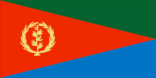
maplink
ercolor.gif
outlinemaplink
erout.gif
visapassenger
-1
maincities
Massawa, Aseb.
largestcity
Asmara
largestcitypopulation
431 000
rankpopulation
116
Population
4 390 000
rankgdp
160
gdp
751000000
rankgdpppp
147
gdpppp
3727000000
rankgni
175
gni
851000000
rankincomeorigin
198
rankincome
212
income
190
rankincomeppp
190
incomeppp
1020
lifeexpectation
52.7
alphabetizationrate
0.578
natalityrate
0.03903
mortalityrate
0.01336
mortalityrateinfantile
0.07559
hdi
0.446
urbanization
0.191
nationalevent
Independence Day
nationaleventfr
Jour de l'Indépendance
nationalholiday
24 May (1993)
Date de naissance aaaa-mm-jj
1993-05-24 00:00:00
10
10
location
Eastern Africa, bordering the Red Sea, between Djibouti and Sudan
terrain
dominated by extension of Ethiopian north-south trending highlands, descending on the east to a coastal desert plain, on the northwest to hilly terrain and on the southwest to flat-to-rolling plains
naturalresources
gold, potash, zinc, copper, salt, possibly oil and
9
rgbback
16777215
todate
1
75
id
Pays
Pays en Anglais
Estonia
Pays
Estonie
countryucasefr
ESTONIE
Pays en Chinois
Pays en Espagnol
Estonia
Pays en Italien
L'Estonia
Pays en Portugais
Estónia
Pays en Allemand
Estland
countrypy
ai4 sha1 ni2 ya4
countrylocal
Eesti Vabariik
countryfull
Estonia
countrynm
Estonia
ISO2
EE
ISO3
EST
countrycodeisono
233
countrycodevehicle
EST
countrycodeolympic
EST
countrycodeirs
EN
countrycodeirsfr
EN
countrycodeirsmixt
EN
♀Féminin
16
6
53
languagesfr
Estonien
38
currency
kroon (pl. krooni)
currencyfr
couronne
currencyisocode
EEK
currencyisocodefull
EEK 233
currencypxcode
EEK
currencysymbol
KR
currencysubdivision
100 senti
currencyregime
German Mark (8.0)
currencyvalue
0.07797
nationalityfr
Estonienne
Capitale
Tallinn
capitalfr
Tallin
Préfixe Tél.
372
Superficie km2
45 100
arealand
43 211
areawater
2 015
landarablerate
0.265
landforestrate
0.487
coastline
3794
summit
Suur Munamägi 318 m.
boundarycountries
Russie, Lettonie
timezonedeltabegin
2
flaglink
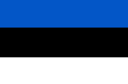
maplink
en-map.gif
outlinemaplink
ee.gif
visapassenger
-1
maincities
Tartu, Narva, Kohtla-Järve, Pämu, Sillamäe, Rakvere.
largestcity
Tallinn
largestcitypopulation
499 000
rankpopulation
147
Population
1 353 000
rankgdp
96
gdp
9082000000
rankgdpppp
101
gdpppp
18318000000
rankgni
101
gni
7276000000
rankincomeorigin
70
rankincome
77
income
5380
rankincomeppp
63
incomeppp
12680
lifeexpectation
70.61
alphabetizationrate
0.99
natalityrate
0.00954
mortalityrate
0.01339
mortalityrateinfantile
0.01173
hdi
0.833
urbanization
0.694
nationalevent
Independence Day
nationaleventfr
Jour de l'Indépendance
nationalholiday
24 February (1918)
Date de naissance aaaa-mm-jj
1918-02-24 00:00:00
5
7
location
Eastern Europe, bordering the Baltic Sea and Gulf of Finland, between Latvia and Russia
terrain
marshy, lowlands; flat in the north, hilly in the south
naturalresources
oil shale, peat, phosphorite, clay, limestone, san
6
Web
rgbback
16777215
todate
1
76
id
Pays
Pays en Anglais
Ethiopia
Pays
Ethiopie
countryucasefr
ETHIOPIE
Pays en Chinois
Pays en Espagnol
Etiopía
Pays en Italien
L'Etiopia
Pays en Portugais
Etiópia
Pays en Allemand
Äthiopien
countrypy
ai3 sai4 e2 bi3 ya4
countrylocal
Ityop'iya
countryfull
Ethiopia
countrynm
Ethiopia
ISO2
ET
ISO3
ETH
countrycodeisono
231
countrycodevehicle
ETH
countrycodeolympic
ETH
countrycodeirs
ET
countrycodeirsfr
ET
countrycodeirsmixt
ET
♀Féminin
4
181
languagesfr
Amharique
135
currency
birr
currencyfr
Birr
currencyisocode
ETB
currencyisocodefull
ETB 230
currencypxcode
ETB
currencysymbol
Br
currencysubdivision
100 cents
currencyregime
float
currencyvalue
0.1154
nationalityfr
Ethiopienne
Capitale
Addis Abeba
capitalfr
Addis Abeba
Préfixe Tél.
251
Superficie km2
1 127 127
arealand
1 119 683
areawater
7 444
landarablerate
0.099
landforestrate
0.042
summit
Ras Dashen Terara 4 620 m.
boundarycountries
Soudan, Erythrée, Djibouti, Somalie, Somaliland, Kenya.
timezonedeltabegin
3
flaglink
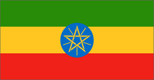
maplink
etcolor.gif
outlinemaplink
etout.gif
visapassenger
-1
maincities
Gonder, Dire Dawa, Dessié, Jimma, A Nazret, Harar, Mak'alé, Bahir Dar.
largestcity
Addis Abeba
largestcitypopulation
2 431 000
rankpopulation
16
Population
68 613 000
rankgdp
106
gdp
6652000000
rankgdpppp
68
gdpppp
48780000000
rankgni
108
gni
6355000000
rankincomeorigin
207
rankincome
220
income
90
rankincomeppp
201
incomeppp
710
lifeexpectation
41.24
alphabetizationrate
0.2766
natalityrate
0.03981
mortalityrate
0.02017
mortalityrateinfantile
0.10322
nationalevent
National Day (defeat of MENGISTU regime)
nationaleventfr
Jour National
nationalholiday
28 May (1991)
Date de naissance aaaa-mm-jj
1991-05-28 00:00:00
8
8
location
Eastern Africa, west of Somalia
terrain
high plateau with central mountain range divided by Great Rift Valley
naturalresources
small reserves of gold, platinum, copper, potash,
9
Web
rgbback
16777215
todate
1
77
id
Pays
Pays en Anglais
Europa Island
Pays
Ile d'Europe
countryucasefr
ILE D'EUROPE
Pays en Chinois
Pays en Espagnol
Isla De Europa
Pays en Italien
Isola Di Europa
Pays en Portugais
Console De Europa
Pays en Allemand
Insel Europa
countryfull
Europa Island
countrynm
Europa Island
ISO2
REUE
ISO3
REUE
countrycodeisono
638
countrycodeirs
EU
countrycodeirsfr
EU
countrycodeirsmixt
IDE
♀Féminin
15
6
57
2
currencypxcode
EUR
Préfixe Tél.
262
Superficie km2
30
arealand
28
coastline
22.2
flaglink
maplink
eu-map.gif
visapassenger
-1
rankincome
222
location
Southern Africa, island in the Mozambique Channel, about one-half of the way from southern Madagascar to southern Mozambique
terrain
low and flat
naturalresources
NEGL
cooking
Southern Africa, island in the Mozambique Channel, about one-half of the way from southern Madagascar to southern Mozambique
9
rgbback
16777215
todate
1
78
id
Pays
Pays en Anglais
Falkland Islands (Islas Malvinas)
Pays
Falkland (îles Malouines)
countryucasefr
FALKLAND (ILES MALOUINES)
Pays en Chinois
Pays en Espagnol
Islas De Falkland (Islas Malvinas)
Pays en Italien
Gli Isole Falkalnd (Islas Malvinas)
Pays en Portugais
Consoles De Falkland (Islas Malvinas)
Pays en Allemand
Falklandinseln (Islas Malvinas)
countryfull
Falkland Islands (Islas Malvinas)
countrynm
Falkland Islands (Islas Malvinas)
ISO2
FK
ISO3
FLK
countrycodeisono
238
countrycodeirs
FK
countrycodeirsfr
FK
countrycodeirsmixt
FK
♀Féminin
12
6
51
39
currency
pound
currencyisocode
FKP
currencyisocodefull
FKP 238
currencypxcode
FKP
currencysymbol
£F
currencysubdivision
100 pence
currencyregime
British Pound (1.0)
currencyvalue
1.6992
Capitale
Port Stanley
capitalfr
Port Stanley
Préfixe Tél.
500
Superficie km2
12 200
arealand
12 173
coastline
1288
timezonedeltabegin
-4
flaglink
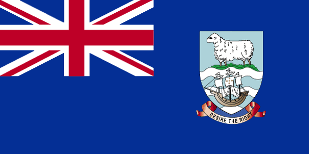
maplink
fkcolor.gif
outlinemaplink
fk.gif
visapassenger
-1
largestcity
Port Stanley
rankpopulation
226
Population
2 100
rankgni
214
gni
40000000
rankincomeorigin
43
rankincome
43
income
13333
nationalevent
Liberation Day
nationaleventfr
Jour de la Libération
nationalholiday
14 June (1982)
Date de naissance aaaa-mm-jj
1982-06-14 00:00:00
9
11
president
Reine Elizabeth II
location
Southern South America, islands in the South Atlantic Ocean, east of southern Argentina
terrain
rocky, hilly, mountainous with some boggy, undulating plains
naturalresources
fish, squid, wildlife, calcified seaweed, sphagnum
9
rgbback
16777215
todate
1
79
id
Pays
Pays en Anglais
Faroe Islands
Pays
Féroé (îles)
countryucasefr
FEROE (ILES)
Pays en Chinois
Pays en Espagnol
Islas De Faroe
Pays en Italien
Isole Di Faroe
Pays en Portugais
Consoles De Faroe
Pays en Allemand
Inseln Faroe
countryfull
Faroe Islands
countrynm
Faroe Islands
ISO2
FO
ISO3
FRO
countrycodeisono
234
countrycodevehicle
FR
countrycodeirs
FO
countrycodeirsfr
FO
countrycodeirsmixt
FO
♀Féminin
12
6
38
languagesfr
Féroïen, Danois
33
currency
krone (pl. kroner)
currencyfr
Couronne
currencyisocode
DKK
currencyisocodefull
DKK 208
currencypxcode
DKK
currencysymbol
Dkr
currencysubdivision
100 øre
currencyregime
EMS-II
currencyvalue
0.164
Capitale
Torshavn
capitalfr
Tórshavn
Préfixe Tél.
298
Superficie km2
1 399
arealand
1 399
landarablerate
0.0214
coastline
1117
summit
Slaettaratindur 882 m.
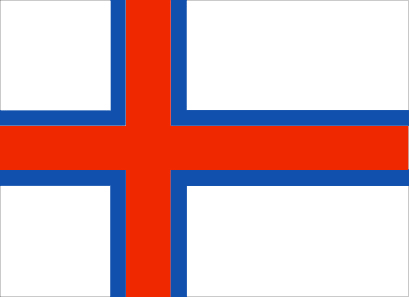
flaglink
maplink
fo-map
outlinemaplink
faeroe.gif
visapassenger
-1
maincities
Klaksvík.
largestcity
Torshavn
rankpopulation
201
Population
47 000
rankgni
184
gni
530000000
rankincomeorigin
47
rankincome
48
income
12045
nationalevent
Olaifest
nationaleventfr
Olaifest
nationalholiday
29 July
Date de naissance aaaa-mm-jj
2000-07-29 00:00:00
7
5
location
Northern Europe, island group between the Norwegian Sea and the North Atlantic Ocean, about one-half of the way from Iceland to Norway
terrain
rugged, rocky, some low peaks; cliffs along most of coast
naturalresources
fish, whales, hydropower
9
Web
rgbback
16777215
todate
1
80
id
Pays
Pays en Anglais
Fiji
Pays
Fidji
countryucasefr
FIDJI
Pays en Chinois
Pays en Espagnol
Las Islas Fiji
Pays en Italien
Le Isole Figi
Pays en Portugais
Consoles De Fiji
Pays en Allemand
Fidschi-Inseln
countrypy
fei3 ji4
countrylocal
Fiji
countryfull
Fiji
countrynm
Fiji
ISO2
FJ
ISO3
FJI
countrycodeisono
242
countrycodevehicle
FJI
countrycodeolympic
FIJ
countrycodeirs
FJ
countrycodeirsfr
FJ
countrycodeirsmixt
FJ
♀Féminin
15
6
51
languagesfr
Anglais
40
currency
dollar
currencyfr
dollar fidjien
currencyisocode
FJD
currencyisocodefull
FJD 242
currencypxcode
FJD
currencysymbol
F$
currencysubdivision
100 cents
currencyregime
composite
currencyvalue
0.5944
Capitale
Suva
capitalfr
Suva
Préfixe Tél.
679
Superficie km2
18 270
arealand
18 270
landarablerate
0.1095
landforestrate
0.446
coastline
1129
summit
Mount Tomaniivi 1 324 m.
timezonedeltabegin
12
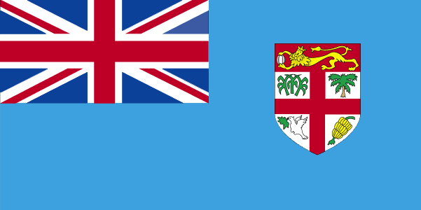
flaglink
maplink
fjcolor.gif
outlinemaplink
fj.gif
visapassenger
-1
maincities
Lautoka, Nadi, Lambasa, Singatoka, Nausori, Levuka.
largestcity
Suva
largestcitypopulation
166 000
rankpopulation
154
Population
835 000
rankgdp
141
gdp
2036000000
rankgdpppp
141
gdpppp
4910000000
rankgni
153
gni
1871000000
rankincomeorigin
103
rankincome
113
income
2240
rankincomeppp
109
incomeppp
5650
lifeexpectation
69.2
alphabetizationrate
0.937
natalityrate
0.02291
mortalityrate
0.00568
mortalityrateinfantile
0.01299
hdi
0.754
urbanization
0.502
nationalevent
Independence Day
nationaleventfr
Jour de l'Indépendance
nationalholiday
Second Monday of October (1970)
Date de naissance aaaa-mm-jj
1970-10-01 00:00:00
7
11
location
Oceania, island group in the South Pacific Ocean, about two-thirds of the way from Hawaii to New Zealand
terrain
mostly mountains of volcanic origin
naturalresources
timber, fish, gold, copper, offshore oil potential
cooking
Fruits de Mer
9
Web
rgbback
16777215
todate
1
Notes
Fruits de Mer
| Pays/Territoires | Régions en Chine | Provinces de Chine | Régions en France | Départements de France | Provinces du Monde | Villes/Villages | Localités | Continents du Monde | Vins AOP
