国家/地区
最后修正 2021-01-12 18:58:56
在此您可以得到世界各国和地区的法文,英文,中文名称。 这个珍贵的全人类共享的土地的集合,不仅包括世界上的独立国家, 而且也包括非联合国联合国:我联合国人民,团结起来追求更美好的世界!会员国的特殊领域。 请咨询 法语国名/地区名阴阳性详表。
61
id
国家/地区
英语国家/地区名
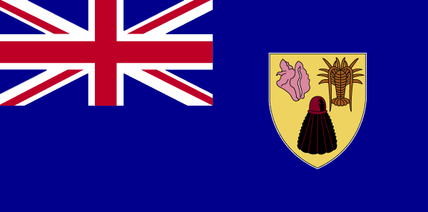
Turks and Caicos Islands
法语国家/地区名
Turks et Caicos (îles)
countryucasefr
TURKS ET CAICOS (ILES)
国家/地区名
西班牙语国家/地区名
Turcos e islas de Caicos
意大利语国家/地区名
Turchi ed isole del Caicos
葡萄牙语国家/地区名
Turks e consoles de Caicos
德语国家/地区名
Türken und Caicosinseln
countryfull
Turks and Caicos Islands
countrynm
Turks and Caicos Islands
国际编码2
TC
国际编码3
TCA
countrycodeisono
796
countrycodeirs
TK
countrycodeirsfr
TK
countrycodeirsmixt
TK
♀女性
12
6
51
6
currency
dollar
currencyfr
dollar des Caraïbes orientales
currencyisocode
USD
currencyisocodefull
USD 840
currencypxcode
USD
currencysymbol
$
currencysubdivision
100 cents
currencyregime
float
currencyvalue
1
首都
Grand Turk
capitalfr
Grand Turk
电话号码前缀
1-649
面积 km2
430
arealand
430
landarablerate
0.0233
coastline
389
timezonedeltabegin
-5
flaglink
maplink
tccolor.gif
outlinemaplink
tc.gif
visapassenger
-1
largestcity
Grand Turk
rankpopulation
217
人口
17 502
rankgni
208
gni
120000000
rankincomeorigin
67
rankincome
71
income
7059
nationalevent
Constitution Day
nationaleventfr
Jour de la Constitution
nationalholiday
30 August (1976)
生日 年-月-日
1976-08-30 00:00:00
3
5
location
Caribbean, two island groups in the North Atlantic Ocean, southeast of The Bahamas, north of Haiti
terrain
low, flat limestone; extensive marshes and mangrove swamps
naturalresources
spiny lobster, conch
9
rgbback
16777215
todate
1
62
id
国家/地区
英语国家/地区名
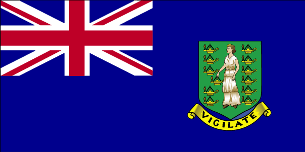
Virgin Islands (UK)
法语国家/地区名
Vierges/Britanniques (îles)
countryucasefr
VIERGES/BRITANNIQUES (ILES)
国家/地区名
西班牙语国家/地区名
Islas De la Virgen (Británicas)
意大利语国家/地区名
Le Isole Vergini (Britanniche)
葡萄牙语国家/地区名
Consoles Do Virgin (Britânicos)
德语国家/地区名
JungfraucInseln (Britisch)
countryfull
British Virgin Islands
countrynm
British Virgin Islands
国际编码2
VG
国际编码3
VGB
countrycodeisono
092
countrycodevehicle
BVI
countrycodeolympic
IVB
countrycodeirs
VI
countrycodeirsfr
VI
countrycodeirsmixt
VI
♀女性
12
6
51
22
currency
pound
currencyisocode
GBP
currencyisocodefull
GBP 826
currencypxcode
GBP
currencysymbol
£
currencysubdivision
100 pence
currencyregime
float
currencyvalue
1.8091
首都
Road Town
capitalfr
Road Town
电话号码前缀
1-284
面积 km2
153
arealand
153
landarablerate
0.2
landforestrate
0.2
coastline
80
timezonedeltabegin
-4
flaglink
maplink
vgcolor.gif
outlinemaplink
vg.gif
visapassenger
-1
largestcity
Road Town
rankpopulation
215
人口
20 353
rankgni
196
gni
270000000
rankincomeorigin
42
rankincome
42
income
13500
nationalevent
Territory Day
nationaleventfr
Jour du Territoire
nationalholiday
1 July
生日 年-月-日
2000-07-01 00:00:00
7
5
president
Reine Elizabeth II
location
Caribbean, between the Caribbean Sea and the North Atlantic Ocean, east of Puerto Rico
terrain
coral islands relatively flat; volcanic islands steep, hilly
naturalresources
NEGL
cooking
The British Virgin Islands are a group of over 50 islands and Cays located in the northeast Caribbean. They include Tortola, Virgin Gorda, Anegada, Jost Van Dyke, Great Camanoe, Guana Island, Peter Island, Salt Island, Beef Island, Cooper Island, Ginger Island, Norman Island, and many other small islands all clustered around Sir Francis Drake Channel. The Caribbean or the West Indies is a group of islands in the Caribbean Sea. ... Tortola is the largest and most populated of the British Virgin Islands. ... Huge boulders litter the beach at The Baths Virgin Gorda is the second-largest of the British Virgin Islands. ... Unlike the other British Virgin Islands, Anegada is a flat atoll. ... At roughly 8 square kilometers, Jost Van Dyke is the smallest of the four main islands of the British Virgin Islands, the northern portion of the archipelago of the Virgin Islands, located in the Atlantic Ocean and Caribbean Sea. ... Great Camanoe is a small island located just north of Beef Island and northeast of Tortola in the British Virgin Islands, a group of islands which forms part of the archipelago of the Virgin Islands, located in the Atlantic Ocean and Caribbean Sea. ... Norman Island is located at the southern tip of the British Virgin Islands archipelago. ...
9
rgbback
16777215
todate
1
63
id
国家/地区
英语国家/地区名
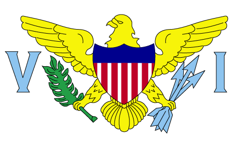
Virgin Islands
法语国家/地区名
Vierges/Américaines (îles)
countryucasefr
VIERGES/AMERICAINES (ILES)
国家/地区名
西班牙语国家/地区名
Islas De la Virgen (los E.E.U.U.)
意大利语国家/地区名
Le Isole Vergini (Stati Uniti)
葡萄牙语国家/地区名
Consoles Do Virgin (E. U.)
德语国家/地区名
JungfraucInseln (US)
countryfull
Virgin Islands
countrynm
Virgin Islands
国际编码2
VI
国际编码3
VIR
countrycodeisono
850
countrycodeolympic
ISV
countrycodeirs
VQ
countrycodeirsfr
VQ
countrycodeirsmixt
VQ
♀女性
17
6
51
languagesfr
Anglais
6
currency
dollar
currencyfr
dollar
currencyisocode
USD
currencyisocodefull
USD 840
currencypxcode
USD
currencysymbol
$
currencysubdivision
100 cents
currencyregime
float
currencyvalue
1
nationalityfr
Américaine
首都
Charlotte Amalie
capitalfr
Charlotte Amalie
电话号码前缀
1-340
面积 km2
352
arealand
349
areawater
3
landarablerate
0.15
landforestrate
0.412
coastline
188
summit
Crown Mountain 474 m.
timezonedeltabegin
-4
flaglink
maplink
vicolor.gif
outlinemaplink
vi.gif
visapassenger
-1
maincities
Frederiksted, Christiansted, Cruz Bay.
largestcity
Charlotte Amalie
rankpopulation
185
人口
125 000
rankgni
148
gni
1960000000
rankincomeorigin
31
rankincome
32
income
16752
lifeexpectation
78.75
natalityrate
0.01449
fecondity
2.21
mortalityrate
0.0061
mortalityrateinfantile
0.00821
growthrate
-0.00054
nationalevent
Transfer Day (from Denmark to the US)
nationaleventfr
Jour du Transfert de Danemark aux Etats-Unis d'Amérique
nationalholiday
27 March (1917)
生日 年-月-日
1917-03-27 00:00:00
4
6
location
Caribbean, islands between the Caribbean Sea and the North Atlantic Ocean, east of Puerto Rico
terrain
mostly hilly to rugged and mountainous with little level land
naturalresources
sun, sand, sea, surf
9
网站
rgbback
16777215
todate
1
64
id
国家/地区
英语国家/地区名
Wake Island
法语国家/地区名
Ile Wake
countryucasefr
ILE WAKE
国家/地区名
西班牙语国家/地区名
Isla De la Estela
意大利语国家/地区名
Isola Di Risveglio
葡萄牙语国家/地区名
Console Da Vigília
德语国家/地区名
SpurcInsel
countryfull
Wake Island
countrynm
Wake Island
国际编码2
UMI1
国际编码3
UMI1
countrycodeisono
581
countrycodeirs
WQ
countrycodeirsfr
WQ
countrycodeirsmixt
WQ
♀女性
17
7
57
6
currency
dollar
currencyisocode
USD
currencyisocodefull
USD 840
currencypxcode
USD
currencysymbol
$
currencysubdivision
100 cents
currencyregime
float
currencyvalue
1
面积 km2
6.50
arealand
6.50
coastline
19.3
timezonedeltabegin
12
flaglink
maplink
wake.gif
visapassenger
-1
rankincome
222
location
Oceania, atoll in the North Pacific Ocean, about two-thirds of the way from Hawaii to the Northern Mariana Islands
terrain
atoll of three coral islands built up on an underwater volcano; central lagoon is former crater, islands are part of the rim
naturalresources
none
cooking
Oceania, atoll in the North Pacific Ocean, about two-thirds of the way from Hawaii to the Northern Mariana Islands
9
rgbback
16777215
todate
1
65
id
国家/地区
英语国家/地区名
Wallis and Futuna
法语国家/地区名
Wallis et Futuna
countryucasefr
WALLIS ET FUTUNA
国家/地区名
西班牙语国家/地区名
Wallis y Futuna
意大利语国家/地区名
Wallis e Futuna
葡萄牙语国家/地区名
Wallis e Futuna
德语国家/地区名
Wallis und Futuna
countryfull
Wallis and Futuna
countrynm
Wallis and Futuna
国际编码2
WF
国际编码3
WLF
countrycodeisono
876
countrycodeirs
WF
countrycodeirsfr
WF
countrycodeirsmixt
WF
♂男性
15
6
57
2
currency
franc
currencyisocode
XPF
currencyisocodefull
XPF 953
currencypxcode
XPF
currencysubdivision
100 centimes
currencyregime
Euro (119.253)
currencyvalue
0.01025
首都
Mata-Utu
capitalfr
Mata-Utu
电话号码前缀
681
面积 km2
274
arealand
274
landarablerate
0.05
coastline
129
timezonedeltabegin
12
flaglink
maplink
wallisf.gif
outlinemaplink
wf.gif
visapassenger
-1
largestcity
Mata-Utu
rankpopulation
218
人口
15 283
rankgni
211
gni
60000000
rankincomeorigin
87
rankincome
90
income
4000
nationalevent
Bastille Day
nationaleventfr
Jour de la prise de la Bastille
nationalholiday
14 July (1789)
生日 年-月-日
1789-07-14 00:00:00
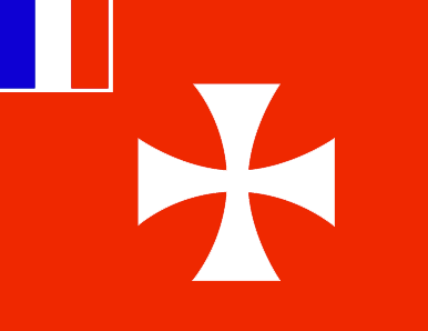
6
10
location
Oceania, islands in the South Pacific Ocean, about two-thirds of the way from Hawaii to New Zealand
terrain
volcanic origin; low hills
naturalresources
NEGL
9
rgbback
16777215
todate
1
66
id
国家/地区
英语国家/地区名
Jarvis Island
法语国家/地区名
Ile Jarvis
countryucasefr
ILE JARVIS
国家/地区名
countryfull
Jarvis Island
countrynm
Jarvis Island
国际编码2
UMI2
国际编码3
UMI2
countrycodeisono
581
countrycodeirs
UM
countrycodeirsfr
UM
countrycodeirsmixt
JAR
♀女性
17
7
51
languagesfr
Anglais
22
currencypxcode
USD
nationalityfr
Américaine
首都
Millersville
capitalfr
Millersville
面积 km2
4.50
arealand
4.50
coastline
8
timezonedeltabegin
-11
flaglink
maplink
dq-map.gif
largestcity
Millersville
rankincome
222
location
Oceania, island in the South Pacific Ocean, about half way between Hawaii and the Cook Islands
terrain
sandy, coral island surrounded by a narrow fringing reef
naturalresources
guano (deposits worked until late 1800s), terrestr
9
rgbback
16777215
todate
1
67
id
国家/地区
英语国家/地区名
Tristan da Cunha Island
法语国家/地区名
Tristan da Cunha
countryucasefr
TRISTAN DA CUNHA
国家/地区名
countryfull
Tristan da Cunha Island
countrynm
Tristan da Cunha Island
国际编码2
TDC
国际编码3
TDC
countrycodeisono
654
countrycodeirs
SH
countrycodeirsfr
SH
countrycodeirsmixt
TDC
♂男性
12
8
51
languagesfr
Anglais
22
currency
Livre Sterling
currencyfr
Livre Sterling
首都
Edingburgh
capitalfr
Edingburgh
电话号码前缀
290
面积 km2
65
arealand
65
flaglink
maplink
tristandc.gif
largestcity
Edingburgh
人口
310
rankincome
222
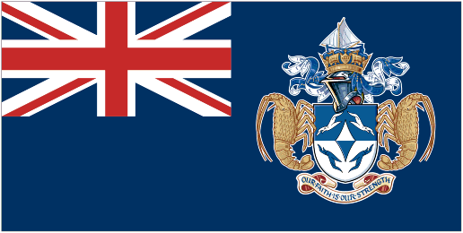
location
Îles situées dans lOcéan Atlantique Sud comprenant lÎle Tristan da Cunha (Tristan da Cunha Island), lÎle Gough (Gough Island), lÎle Inaccessible (Inaccessible Island) et lÎle Nightingale (Nightingale Island).
9
rgbback
16777215
todate
1
小注
Belongs to Saint Helena
68
id
国家/地区
英语国家/地区名
Aaland Islands
法语国家/地区名
Iles Aaland
countryucasefr
ILES AALAND
国家/地区名
countryfull
Aaland Islands
countrynm
Aaland Islands
国际编码2
AX
国际编码3
ALA
countrycodeisono
248
♀女性
4
6
152
languagesfr
Suédois
religions
Catholic
2
currency
Euro
currencyfr
Euro
currencyisocode
EUR
currencyisocodefull
EUR 978
currencypxcode
EUR
currencysymbol
€
currencysubdivision
100 cents
currencyregime
float
currencyvalue
1.2203
nationality
Finnish
nationalityfr
Finnois
首都
Mariehamn
capitalfr
Mariehamn
longtitude
19.9
latitude
60.7
面积 km2
13 517
arealand
13 517
areawater
89
timezonedeltabegin
2
flaglink

maplink
aaland.png
maincities
Mariehamn
largestcity
Mariehamn
人口
27 210
9
rgbback
16777215
todate
1
69
id
国家/地区
英语国家/地区名
Sicily
法语国家/地区名
Sicile
countryucasefr
SICILE
国家/地区名
西班牙语国家/地区名
Sicily
意大利语国家/地区名
Sicilia
葡萄牙语国家/地区名
Sicily
德语国家/地区名
Sicily
countrylocal
Sicilia
countryfull
Sicily
countrynm
Sicily
国际编码2
ITAS
国际编码3
ITAS
countrycodeisono
380
countrycodevehicle
I
countrycodeolympic
ITA
countrycodeirs
IT
countrycodeirsfr
IT
countrycodeirsmixt
SCL
countrycode
39
countrycodefr
39
♀女性
1
4
6
84
languagesfr
Italien
religions
Catholic, others
2
currency
Euro
currencyfr
Euro
currencyisocode
EUR
currencyisocodefull
EUR 978
currencypxcode
EUR
currencysymbol
€
currencysubdivision
100 cents
currencyregime
float
currencyvalue
1.2203
nationality
Italian
nationalityfr
Italienne
首都
Palermo
capitalfr
Palerme
电话号码前缀
39
longtitude
38
latitude
13.5
面积 km2
25 426
arealand
25 706
summit
Mt. Etna (an active volcano), rises 3 323m
The central plateau slopes to coastal
timezonedeltabegin
1
flaglink
maplink
sicilymap.gif
outlinemaplink
sicilyout.gif
maincities
Palermo
largestcity
Palermo
largestcitypopulation
676 000
人口
5 200 000
location
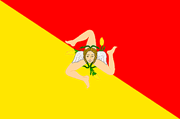
Sicily is the largest island (25,426 sq. km.) in the Mediterranean; it is also the most important economically and has the richest heritage of history and art. Its geographical particularity lies in its compact but varied orographical structure, the uniformity of its rivers, the typically Mediterranean climate and the insularity which has helped Sicily to experience homogeneous historical development with originality of custom, art and culture.
Together with the minor Aeolian islands (the Lipari), Ustica, Egadi, Pantelleria and the distant Pelagie, Sicily is the most extensive region in Italy, though it has only the fourth highest population. The population density is slightly higher than the national average.
The island is bounded by the Tyrrhenian Sea to the north, the Ionian to the east and the Sicilian Sea to the south-west; the Strait of Messina separates it from Calabria.
terrain
Most of the island is a mountainous plateau. The highest point, Mt. Etna (an active volcano), rises to 10,902 ft. (3,323m). The central plateau slopes to coastal lowlands, fertile areas drained by many small rivers amd streams.
Significant rivers include the Salso and Simeta.
7
rgbback
16777215
todate
1
